Stoung geodata
Stoung (Kampong Thom) is a seat of a second-order administrative division; located in Cambodia in Asia/Phnom_Penh (GMT+7) time zone. In our database, there are 29 cities with bigger population. Compared to other cities in Cambodia, 65.9% of cities are located further ↓South; 50.8% of cities are located further →East and 65.2% of cities have higher elevation than Stoung. Note1


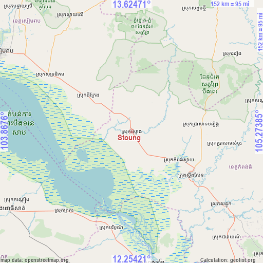
Stoung GPS coordinates[2]
12° 56' 25.44" North, 104° 34' 14.592" East
| Map corner | latitude | longitude |
|---|---|---|
| Upper-left | 13.62471°, | 103.8676° |
| Center: | 12.9404°, | 104.57072° |
| Lower-right: | 12.25421°, | 105.27385° |
| Map W x H: | 152.4×152.4 km | = 94.7×94.7mi |
| max Lat: | 14.23223° ⇑34.1% North |
| Stoung: | 12.9404° |
| min Lat: | ⇓65.9% South 10.48291° |
| min Long | Stoung | max Long |
| 102.37574° | 104.57072° | 107.42393° |
| W 49.2%⇐ | ⇒50.8% E |
Elevation
Elevation of Stoung is 17 m = 56 ft, and this is 35 m = 115 ft below average elevation for this country.
| Max E: |
678 m = 2224 ft | 65.2% |
| Avg. | 52 m = 171 ft | |
| Stoung | 17 m = 56 ft | |
Min E: |
4 m = 13 ft | 34.8% |
See also: Cambodia elevation on elevation.city.
Geographical zone
Stoung is located in North Torrid zone (between Equator and Tropic of Cancer). Distance of this Northern Tropic circle is 1167.1 km =725.2 mi to North.| Distance of | km | miles | from Stoung |
|---|---|---|---|
| North Pole | 8568.2 | 5324 | to North |
| Arctic Circle | 5962.3 | 3704.8 | to North |
| Tropic Cancer | 1167.1 | 725.2 | to North |
| Equator | 1438.8 | 894 | to South |


Nearby cities:
15 places around Stoung: (largest is in red/bold)
• Angkor Thum
96.6 km =60 mi,  308°
308°
• Bakan
93.1 km =57.8 mi,  246°
246°
• Bakong
77.7 km =48.3 mi, 305°
• Baray
81.7 km =50.8 mi,  137°
137°
• Baribour
57.1 km =35.5 mi,  191°
191°
• Chi Kraeng
31.6 km =19.6 mi, 309°
• Kampong Chhnang
77.5 km =48.2 mi,  172°
172°
• Kampong Leaeng
76 km =47.2 mi, 167°
• Kampong Thom
42.9 km =26.7 mi,  126°
126°
• Pursat
83.6 km =51.9 mi,  237°
237°
• Sandan
76.2 km =47.3 mi,  76°
76°
• Sangkom Thmei
80.3 km =49.9 mi,  27°
27°
• Siem Reap
90 km =55.9 mi,  301°
301°
• Soutr Nikom
57.4 km =35.7 mi, 305°
• Stueng Saen
43.1 km =26.8 mi, 126°
Sources, notices
• [Note1] Compared only with cities in Cambodia existing in our database
• [Src1] Map data: © OpenStreetMap contributors (CC-BY-SA)
• [Src2] Other city data from geonames.org with taken over terms of usage.
• [Src3] Geographical zone / Annual Mean Temperature by Robert A. Rohde @ Wikipedia
