Stueng Saen geodata
Stueng Saen (Kampong Thom) is a seat of a second-order administrative division; located in Cambodia in Asia/Phnom_Penh (GMT+7) time zone. In our database, there are 29 cities with bigger population. Compared to other cities in Cambodia, 61.4% of cities are located further ↓South; 59.1% of cities are located further ←West and 72% of cities have higher elevation than Stueng Saen. Note1


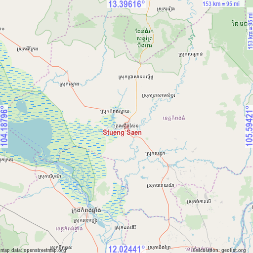
Stueng Saen GPS coordinates[2]
12° 42' 40.356" North, 104° 53' 27.888" East
| Map corner | latitude | longitude |
|---|---|---|
| Upper-left | 13.39616°, | 104.18796° |
| Center: | 12.71121°, | 104.89108° |
| Lower-right: | 12.02441°, | 105.59421° |
| Map W x H: | 152.5×152.5 km | = 94.8×94.8mi |
| max Lat: | 14.23223° ⇑38.6% North |
| Stueng Saen: | 12.71121° |
| min Lat: | ⇓61.4% South 10.48291° |
| min Long | Stueng Saen | max Long |
| 102.37574° | 104.89108° | 107.42393° |
| W 59.1%⇐ | ⇒40.9% E |
Elevation
Elevation of Stueng Saen is 16 m = 52 ft, and this is 36 m = 118 ft below average elevation for this country.
| Max E: |
678 m = 2224 ft | 72% |
| Avg. | 52 m = 171 ft | |
| Stueng Saen | 16 m = 52 ft | |
Min E: |
4 m = 13 ft | 28% |
See also: Cambodia elevation on elevation.city.
Geographical zone
Stueng Saen is located in North Torrid zone (between Equator and Tropic of Cancer). Distance of this Northern Tropic circle is 1192.6 km =741 mi to North.| Distance of | km | miles | from Stueng Saen |
|---|---|---|---|
| North Pole | 8593.7 | 5339.9 | to North |
| Arctic Circle | 5987.8 | 3720.6 | to North |
| Tropic Cancer | 1192.6 | 741 | to North |
| Equator | 1413.4 | 878.2 | to South |


Nearby cities:
15 places around Stueng Saen: (largest is in red/bold)
• Baray
40.5 km =25.2 mi,  150°
150°
• Baribour
55.5 km =34.5 mi,  236°
236°
• Batheay
80.5 km =50 mi,  176°
176°
• Chamkar Leu
61.7 km =38.3 mi,  136°
136°
• Cheung Prey
75.4 km =46.9 mi,  164°
164°
• Chi Kraeng
74.7 km =46.4 mi,  307°
307°
• Kampong Chhnang
56.8 km =35.3 mi,  205°
205°
• Kampong Leaeng
51.7 km =32.1 mi,  200°
200°
• Kampong Thom
0.3 km =0.2 mi,  267°
267°
• Kang Meas
94.7 km =58.8 mi, 153°
• Prey Chhor
82.8 km =51.4 mi, 151°
• Sandan
58.8 km =36.5 mi,  41°
41°
• Sangkom Thmei
96.8 km =60.1 mi,  1°
1°
• Stoung
43.1 km =26.8 mi, 306°
• Stueng Trang
86.3 km =53.6 mi,  125°
125°
Sources, notices
• [Note1] Compared only with cities in Cambodia existing in our database
• [Src1] Map data: © OpenStreetMap contributors (CC-BY-SA)
• [Src2] Other city data from geonames.org with taken over terms of usage.
• [Src3] Geographical zone / Annual Mean Temperature by Robert A. Rohde @ Wikipedia
