Chamkar Leu geodata
Chamkar Leu (Kampong Cham) is a seat of a second-order administrative division; located in Cambodia in Asia/Phnom_Penh (GMT+7) time zone. In our database, there are 29 cities with bigger population. Compared to other cities in Cambodia, 52.3% of cities are located further ↓South; 75% of cities are located further ←West and 75% of cities have lower elevation than Chamkar Leu. Note1


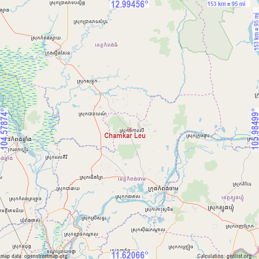
Chamkar Leu GPS coordinates[2]
12° 18' 30.636" North, 105° 16' 54.696" East
| Map corner | latitude | longitude |
|---|---|---|
| Upper-left | 12.99456°, | 104.57874° |
| Center: | 12.30851°, | 105.28186° |
| Lower-right: | 11.62066°, | 105.98499° |
| Map W x H: | 152.8×152.8 km | = 94.9×94.9mi |
| max Lat: | 14.23223° ⇑47.7% North |
| Chamkar Leu: | 12.30851° |
| min Lat: | ⇓52.3% South 10.48291° |
| min Long | Chamkar Leu | max Long |
| 102.37574° | 105.28186° | 107.42393° |
| W 75%⇐ | ⇒25% E |
Elevation
Elevation of Chamkar Leu is 52 m = 171 ft, and this is 0 m = 0 ft above average elevation for this country.
| Max E: |
678 m = 2224 ft | 25% |
| Chamkar Leu | 52 m 171 ft | |
| Avg. | 52 m = 171 ft | |
Min E: |
4 m = 13 ft | 75% |
See also: Cambodia elevation on elevation.city.
Geographical zone
Chamkar Leu is located in North Torrid zone (between Equator and Tropic of Cancer). Distance of this Northern Tropic circle is 1237.3 km =768.8 mi to North.| Distance of | km | miles | from Chamkar Leu |
|---|---|---|---|
| North Pole | 8638.5 | 5367.7 | to North |
| Arctic Circle | 6032.6 | 3748.5 | to North |
| Tropic Cancer | 1237.3 | 768.8 | to North |
| Equator | 1368.6 | 850.4 | to South |


Nearby cities:
15 places around Chamkar Leu: (largest is in red/bold)
• Baray
24.4 km =15.2 mi,  293°
293°
• Batheay
51.2 km =31.8 mi,  226°
226°
• Cheung Prey
35.9 km =22.3 mi,  218°
218°
• Kampong Cham
40.2 km =25 mi,  150°
150°
• Kampong Chhnang
67.2 km =41.8 mi,  264°
264°
• Kampong Leaeng
60.4 km =37.5 mi,  266°
266°
• Kampong Thom
61.8 km =38.4 mi,  316°
316°
• Kang Meas
40.3 km =25 mi,  181°
181°
• Kaoh Soutin
49.6 km =30.8 mi,  161°
161°
• Mukh Kampul
71.8 km =44.6 mi,  207°
207°
• Prey Chhor
28 km =17.4 mi,  185°
185°
• Sithor Kandal
60.6 km =37.7 mi,  169°
169°
• Stueng Saen
61.7 km =38.3 mi, 316°
• Stueng Trang
28.1 km =17.5 mi,  102°
102°
• Suong
60.2 km =37.4 mi,  137°
137°
Sources, notices
• [Note1] Compared only with cities in Cambodia existing in our database
• [Src1] Map data: © OpenStreetMap contributors (CC-BY-SA)
• [Src2] Other city data from geonames.org with taken over terms of usage.
• [Src3] Geographical zone / Annual Mean Temperature by Robert A. Rohde @ Wikipedia
