Prey Chhor geodata
Prey Chhor (Kampong Cham) is a seat of a second-order administrative division; located in Cambodia in Asia/Phnom_Penh (GMT+7) time zone. In our database, there are 29 cities with bigger population. Compared to other cities in Cambodia, 53% of cities are located further ↑North; 73.5% of cities are located further ←West and 67.4% of cities have lower elevation than Prey Chhor. Note1


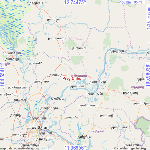
Prey Chhor GPS coordinates[2]
12° 3' 28.944" North, 105° 15' 26.028" East
| Map corner | latitude | longitude |
|---|---|---|
| Upper-left | 12.74475°, | 104.55411° |
| Center: | 12.05804°, | 105.25723° |
| Lower-right: | 11.36956°, | 105.96036° |
| Map W x H: | 152.9×152.9 km | = 95×95mi |
| max Lat: | 14.23223° ⇑53% North |
| Prey Chhor: | 12.05804° |
| min Lat: | ⇓47% South 10.48291° |
| min Long | Prey Chhor | max Long |
| 102.37574° | 105.25723° | 107.42393° |
| W 73.5%⇐ | ⇒26.5% E |
Elevation
Elevation of Prey Chhor is 32 m = 105 ft, and this is 20 m = 66 ft below average elevation for this country.
| Max E: |
678 m = 2224 ft | 32.6% |
| Avg. | 52 m = 171 ft | |
| Prey Chhor | 32 m = 105 ft | |
Min E: |
4 m = 13 ft | 67.4% |
See also: Cambodia elevation on elevation.city.
Geographical zone
Prey Chhor is located in North Torrid zone (between Equator and Tropic of Cancer). Distance of this Northern Tropic circle is 1265.2 km =786.2 mi to North.| Distance of | km | miles | from Prey Chhor |
|---|---|---|---|
| North Pole | 8666.3 | 5385 | to North |
| Arctic Circle | 6060.4 | 3765.8 | to North |
| Tropic Cancer | 1265.2 | 786.2 | to North |
| Equator | 1340.7 | 833.1 | to South |


Nearby cities:
15 places around Prey Chhor: (largest is in red/bold)
• Baray
42.3 km =26.3 mi,  332°
332°
• Batheay
35.1 km =21.8 mi,  257°
257°
• Chamkar Leu
28 km =17.4 mi,  5°
5°
• Cheung Prey
19.8 km =12.3 mi,  269°
269°
• Kampong Cham
23.6 km =14.7 mi,  107°
107°
• Kampong Leaeng
62.4 km =38.8 mi,  292°
292°
• Kang Meas
12.6 km =7.8 mi,  171°
171°
• Kaoh Soutin
26.7 km =16.6 mi,  135°
135°
• Mukh Kampul
47 km =29.2 mi,  220°
220°
• Ponhea Lueu
61.7 km =38.3 mi, 223°
• Prey Veaeng
57 km =35.4 mi,  161°
161°
• Ruessei Kaev
61.3 km =38.1 mi, 218°
• Sithor Kandal
34.5 km =21.4 mi, 156°
• Stueng Trang
37.4 km =23.2 mi,  53°
53°
• Suong
46.5 km =28.9 mi, 110°
Sources, notices
• [Note1] Compared only with cities in Cambodia existing in our database
• [Src1] Map data: © OpenStreetMap contributors (CC-BY-SA)
• [Src2] Other city data from geonames.org with taken over terms of usage.
• [Src3] Geographical zone / Annual Mean Temperature by Robert A. Rohde @ Wikipedia
