Kuma Village geodata
Kuma Village (Gilbert Islands) is a populated place; located in Kiribati in Pacific/Tarawa (GMT+12) time zone. With population of 635 people, there are 25 cities with bigger population in this country. Compared to other cities in Kiribati, 91.4% of cities are located further ↓South; 82.9% of cities are located further →East and 60% of cities have higher elevation than Kuma Village. Note1


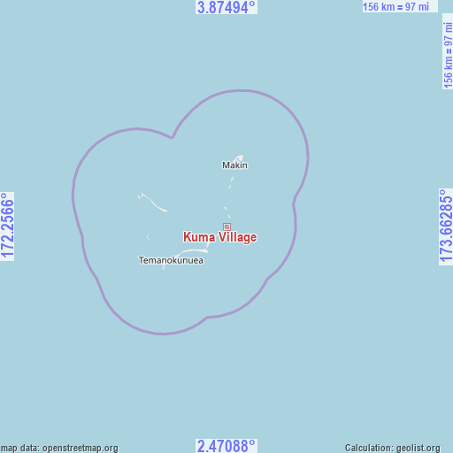
Kuma Village GPS coordinates[2]
3° 10' 23.34" North, 172° 57' 34.992" East
| Map corner | latitude | longitude |
|---|---|---|
| Upper-left | 3.87494°, | 172.2566° |
| Center: | 3.17315°, | 172.95972° |
| Lower-right: | 2.47088°, | 173.66285° |
| Map W x H: | 156.1×156.1 km | = 97×97mi |
| max Lat: | 3.90806° ⇑8.6% North |
| Kuma Village: | 3.17315° |
| min Lat: | ⇓91.4% South -2.65512° |
| min Long | Kuma Village | max Long |
| -159.38832° | 172.95972° | 176.83302° |
| W 17.1%⇐ | ⇒82.9% E |
Elevation
Elevation of Kuma Village is 10 m = 33 ft, and this is 0.1 m = 0 ft above average elevation for this country.
| Max E: |
13 m = 43 ft | 60% |
| Kuma Village | 10 m 33 ft | |
| Avg. | 9.9 m = 32 ft | |
Min E: |
6 m = 20 ft | 40% |
See also: Kiribati elevation on elevation.city.
Geographical zone
Kuma Village is located in North Torrid zone (between Equator and Tropic of Cancer). Distance of Equator is 352.8 km =219.2 mi to South.| Distance of | km | miles | from Kuma Village |
|---|---|---|---|
| North Pole | 9654.2 | 5998.8 | to North |
| Arctic Circle | 7048.4 | 4379.7 | to North |
| Tropic Cancer | 2253.1 | 1400 | to North |
| Equator | 352.8 | 219.2 | to South |


Nearby cities:
15 places around Kuma Village: (largest is in red/bold)
• Abarao Village
202 km =125.5 mi,  175°
175°
• Ambo Village
202.6 km =125.9 mi, 177°
• Betio Village
201.9 km =125.5 mi, 181°
• Bikenibeu Village
201.6 km =125.3 mi,  174°
174°
• Bonriki Village
200.3 km =124.5 mi, 174°
• Buariki Village
173.9 km =108.1 mi, 180°
• Buota Village
199.1 km =123.7 mi, 174°
• Eita Village
201.9 km =125.5 mi, 176°
• Kiebu Village
16.8 km =10.4 mi,  5°
5°
• Makin Village
21.4 km =13.3 mi, 7°
• Nawerewere Village
202.2 km =125.6 mi, 174°
• Rawannawi Village
129 km =80.2 mi,  164°
164°
• Taborio Village
183.9 km =114.3 mi, 178°
• Taborio Village
202.3 km =125.7 mi, 177°
• Temaiku Village
202.5 km =125.8 mi, 173°
Sources, notices
• [Note1] Compared only with cities in Kiribati existing in our database
• [Src1] Map data: © OpenStreetMap contributors (CC-BY-SA)
• [Src2] Other city data from geonames.org with taken over terms of usage.
• [Src3] Geographical zone / Annual Mean Temperature by Robert A. Rohde @ Wikipedia
