Ouanani geodata
Ouanani (Mohéli) is a populated place; located in Comoros in Indian/Comoro (GMT+3) time zone. With population of 2,401 people, there are 39 cities with bigger population in this country. Compared to other cities in Comoros, 94.7% of cities are located further ↑North; 58.4% of cities are located further ←West and 67.3% of cities have lower elevation than Ouanani. Note1


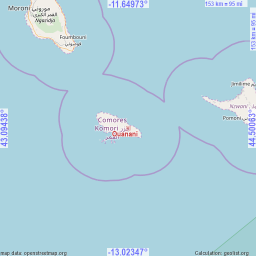
Ouanani GPS coordinates[2]
12° 20' 15" South, 43° 47' 51" East
| Map corner | latitude | longitude |
|---|---|---|
| Upper-left | -11.64973°, | 43.09438° |
| Center: | -12.3375°, | 43.7975° |
| Lower-right: | -13.02347°, | 44.50063° |
| Map W x H: | 152.7×152.7 km | = 94.9×94.9mi |
| max Lat: | -11.38472° ⇑94.7% North |
| Ouanani: | -12.3375° |
| min Lat: | ⇓5.3% South -12.37306° |
| min Long | Ouanani | max Long |
| 43.2525° | 43.7975° | 44.53194° |
| W 58.4%⇐ | ⇒41.6% E |
Elevation
Elevation of Ouanani is 217 m = 712 ft, and this is 20.9 m = 69 ft above average elevation for this country.
| Max E: |
924 m = 3031 ft | 32.7% |
| Ouanani | 217 m 712 ft | |
| Avg. | 196.1 m = 643 ft | |
Min E: |
1 m = 3 ft | 67.3% |
See also: Comoros elevation on elevation.city.
Geographical zone
Ouanani is located in South Torrid zone (between Equator and Tropic of Capricorn). Distance of this Southern Tropic circle is 1234.1 km =766.8 mi to South.| Distance of | km | miles | from Ouanani |
|---|---|---|---|
| Equator | 1371.8 | 852.4 | to North |
| Tropic Capricorn | 1234.1 | 766.8 | to South |
| Antarctic Circle | 6029.4 | 3746.5 | to South |
| South Pole | 8635.3 | 5365.7 | to South |


Nearby cities:
15 places around Ouanani: (largest is in red/bold)
• Bimbini
50.4 km =31.3 mi,  70°
70°
• Djoyézi
4.3 km =2.7 mi,  324°
324°
• Fomboni
8.1 km =5 mi,  313°
313°
• Hamavouna
5.9 km =3.7 mi,  131°
131°
• Hamba
19.3 km =12 mi,  291°
291°
• Hoani
16.5 km =10.3 mi, 305°
• Itsamia
8.2 km =5.1 mi,  111°
111°
• Kangani
2.5 km =1.6 mi,  103°
103°
• Kavani
53.8 km =33.4 mi, 72°
• Milembéni
53 km =32.9 mi, 72°
• Miringoni
18.2 km =11.3 mi,  284°
284°
• Mirongani
52.1 km =32.4 mi, 71°
• Mtakoudja
13.3 km =8.3 mi, 309°
• Nioumachoua
9.3 km =5.8 mi,  253°
253°
• Ziroudani
2.2 km =1.4 mi, 284°
Sources, notices
• [Note1] Compared only with cities in Comoros existing in our database
• [Src1] Map data: © OpenStreetMap contributors (CC-BY-SA)
• [Src2] Other city data from geonames.org with taken over terms of usage.
• [Src3] Geographical zone / Annual Mean Temperature by Robert A. Rohde @ Wikipedia
