Hahoe-dong geodata
Hahoe-dong (Hamgyŏng-bukto) is a seat of a third-order administrative division; located in North Korea in Asia/Pyongyang (GMT+9) time zone. In our database, there are 78 cities with bigger population. Compared to other cities in North Korea, 89% of cities are located further ↓South; 100% of cities are located further ←West and 63.7% of cities have higher elevation than Hahoe-dong. Note1


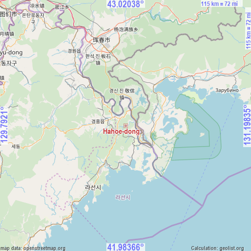
Hahoe-dong GPS coordinates[2]
42° 30' 15.012" North, 130° 29' 42.792" East
| Map corner | latitude | longitude |
|---|---|---|
| Upper-left | 43.02038°, | 129.7921° |
| Center: | 42.50417°, | 130.49522° |
| Lower-right: | 41.98366°, | 131.19835° |
| Map W x H: | 115.3×115.3 km | = 71.6×71.6mi |
| max Lat: | 42.95722° ⇑11% North |
| Hahoe-dong: | 42.50417° |
| min Lat: | ⇓89% South 37.90889° |
| min Long | Hahoe-dong | max Long |
| 124.39806° | 130.49522° | 130.49522° |
| W 100%⇐ | ⇒0% E |
Elevation
Elevation of Hahoe-dong is 24 m = 79 ft, and this is 107.7 m = 353 ft below average elevation for this country.
| Max E: |
1466 m = 4810 ft | 63.7% |
| Avg. | 131.7 m = 432 ft | |
| Hahoe-dong | 24 m = 79 ft | |
Min E: |
1 m = 3 ft | 36.3% |
See also: North Korea elevation on elevation.city.
Geographical zone
Hahoe-dong is located in North temperate zone (between Tropic of Cancer and the Arctic Circle). Distance of this Northern Tropic circle is 2120.1 km =1317.4 mi to South.| Distance of | km | miles | from Hahoe-dong |
|---|---|---|---|
| North Pole | 5281 | 3281.5 | to North |
| Arctic Circle | 2675.2 | 1662.3 | to North |
| Tropic Cancer | 2120.1 | 1317.4 | to South |
| Equator | 4726 | 2936.6 | to South |


Nearby cities:
15 places around Hahoe-dong: (largest is in red/bold)
• Aoji
8.3 km =5.2 mi,  285°
285°
• Chungbong
50.7 km =31.5 mi,  279°
279°
• Hoeryŏng
61.8 km =38.4 mi,  263°
263°
• Kogŏnwon
29.8 km =18.5 mi,  306°
306°
• Kwirak
14.4 km =8.9 mi,  265°
265°
• Kyŏngwŏn
44.4 km =27.6 mi,  320°
320°
• Onsŏng
64.9 km =40.3 mi, 320°
• Rajin
32.7 km =20.3 mi,  212°
212°
• Ryongdang
32.9 km =20.4 mi, 318°
• Sambong
60.9 km =37.8 mi, 289°
• Sech’ŏn
54.5 km =33.9 mi, 278°
• Sŏnbong
19.3 km =12 mi, 208°
• Ungsang
17 km =10.6 mi,  181°
181°
• Ungsang-nodongjagu
16.5 km =10.3 mi,  189°
189°
• Ŭndŏk
13.2 km =8.2 mi, 277°
Sources, notices
• [Note1] Compared only with cities in North Korea existing in our database
• [Src1] Map data: © OpenStreetMap contributors (CC-BY-SA)
• [Src2] Other city data from geonames.org with taken over terms of usage.
• [Src3] Geographical zone / Annual Mean Temperature by Robert A. Rohde @ Wikipedia
