Rajin geodata
Rajin (Rason) is a seat of a first-order administrative division; located in North Korea in Asia/Pyongyang (GMT+9) time zone. With population of 66,224 people, there are 19 cities with bigger population in this country. Compared to other cities in North Korea, 81.3% of cities are located further ↓South; 92.3% of cities are located further ←West and 59.3% of cities have lower elevation than Rajin. Note1


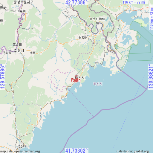
Rajin GPS coordinates[2]
42° 15' 20.124" North, 130° 16' 59.088" East
| Map corner | latitude | longitude |
|---|---|---|
| Upper-left | 42.77386°, | 129.57996° |
| Center: | 42.25559°, | 130.28308° |
| Lower-right: | 41.73302°, | 130.98621° |
| Map W x H: | 115.7×115.7 km | = 71.9×71.9mi |
| max Lat: | 42.95722° ⇑18.7% North |
| Rajin: | 42.25559° |
| min Lat: | ⇓81.3% South 37.90889° |
| min Long | Rajin | max Long |
| 124.39806° | 130.28308° | 130.49522° |
| W 92.3%⇐ | ⇒7.7% E |
Elevation
Elevation of Rajin is 68 m = 223 ft, and this is 63.7 m = 209 ft below average elevation for this country.
| Max E: |
1466 m = 4810 ft | 40.7% |
| Avg. | 131.7 m = 432 ft | |
| Rajin | 68 m = 223 ft | |
Min E: |
1 m = 3 ft | 59.3% |
See also: Rajin elevation on elevation.city.
Geographical zone
Rajin is located in North temperate zone (between Tropic of Cancer and the Arctic Circle). Distance of this Northern Tropic circle is 2092.5 km =1300.2 mi to South.| Distance of | km | miles | from Rajin |
|---|---|---|---|
| North Pole | 5308.7 | 3298.7 | to North |
| Arctic Circle | 2702.8 | 1679.4 | to North |
| Tropic Cancer | 2092.5 | 1300.2 | to South |
| Equator | 4698.4 | 2919.4 | to South |


Nearby cities:
15 places around Rajin: (largest is in red/bold)
• Aoji
31.3 km =19.4 mi,  17°
17°
• Chungbong
48.5 km =30.1 mi,  317°
317°
• Hahoe-dong
32.7 km =20.3 mi,  32°
32°
• Hoeryŏng
48.7 km =30.3 mi,  295°
295°
• Kogŏnwon
45.8 km =28.5 mi,  351°
351°
• Komusan Il-tong
50.7 km =31.5 mi,  251°
251°
• Kwirak
26.6 km =16.5 mi,  6°
6°
• Puryŏng
51.9 km =32.2 mi, 245°
• Ryongdang
52.3 km =32.5 mi, 354°
• Sech’ŏn
51.2 km =31.8 mi,  314°
314°
• Sŏnbong
13.4 km =8.3 mi,  37°
37°
• Sŏng-dong
55 km =34.2 mi,  286°
286°
• Ungsang
20 km =12.4 mi,  57°
57°
• Ungsang-nodongjagu
18.6 km =11.6 mi,  52°
52°
• Ŭndŏk
29.6 km =18.4 mi, 8°
Sources, notices
• [Note1] Compared only with cities in North Korea existing in our database
• [Src1] Map data: © OpenStreetMap contributors (CC-BY-SA)
• [Src2] Other city data from geonames.org with taken over terms of usage.
• [Src3] Geographical zone / Annual Mean Temperature by Robert A. Rohde @ Wikipedia
