Ungsang-nodongjagu geodata
Ungsang-nodongjagu (Rason) is a populated locality; located in North Korea in Asia/Pyongyang (GMT+9) time zone. With population of 8,410 people, there are 77 cities with bigger population in this country. Compared to other cities in North Korea, 84.6% of cities are located further ↓South; 97.8% of cities are located further ←West and 52.7% of cities have higher elevation than Ungsang-nodongjagu. Note1


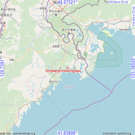
Ungsang-nodongjagu GPS coordinates[2]
42° 21' 28.008" North, 130° 27' 43.992" East
| Map corner | latitude | longitude |
|---|---|---|
| Upper-left | 42.87521°, | 129.7591° |
| Center: | 42.35778°, | 130.46222° |
| Lower-right: | 41.83606°, | 131.16535° |
| Map W x H: | 115.5×115.5 km | = 71.8×71.8mi |
| max Lat: | 42.95722° ⇑15.4% North |
| Ungsang-nodongjagu: | 42.35778° |
| min Lat: | ⇓84.6% South 37.90889° |
| min Long | Ungsang-nodongj | max Long |
| 124.39806° | 130.46222° | 130.49522° |
| W 97.8%⇐ | ⇒2.2% E |
Elevation
Elevation of Ungsang-nodongjagu is 40 m = 131 ft, and this is 91.7 m = 301 ft below average elevation for this country.
| Max E: |
1466 m = 4810 ft | 52.7% |
| Avg. | 131.7 m = 432 ft | |
| Ungsang-nodongjagu | 40 m = 131 ft | |
Min E: |
1 m = 3 ft | 47.3% |
See also: North Korea elevation on elevation.city.
Geographical zone
Ungsang-nodongjagu is located in North temperate zone (between Tropic of Cancer and the Arctic Circle). Distance of this Northern Tropic circle is 2103.8 km =1307.2 mi to South.| Distance of | km | miles | from Ungsang-nodongjagu |
|---|---|---|---|
| North Pole | 5297.3 | 3291.6 | to North |
| Arctic Circle | 2691.4 | 1672.4 | to North |
| Tropic Cancer | 2103.8 | 1307.2 | to South |
| Equator | 4709.7 | 2926.5 | to South |


Nearby cities:
15 places around Ungsang-nodongjagu: (largest is in red/bold)
• Aoji
19.3 km =12 mi,  343°
343°
• Chungbong
53.3 km =33.1 mi,  297°
297°
• Hahoe-dong
16.5 km =10.3 mi,  9°
9°
• Hoeryŏng
59.5 km =37 mi,  278°
278°
• Kogŏnwon
40.1 km =24.9 mi,  327°
327°
• Kwirak
19 km =11.8 mi,  322°
322°
• Kyŏngwŏn
56.7 km =35.2 mi, 333°
• Rajin
18.6 km =11.6 mi,  232°
232°
• Ryongdang
45.1 km =28 mi, 334°
• Sambong
65.9 km =40.9 mi, 303°
• Sech’ŏn
56.8 km =35.3 mi, 295°
• Sŏnbong
6.5 km =4 mi,  263°
263°
• Sŏng-dong
67.6 km =42 mi,  273°
273°
• Ungsang
2.2 km =1.4 mi,  108°
108°
• Ŭndŏk
20.7 km =12.9 mi, 329°
Sources, notices
• [Note1] Compared only with cities in North Korea existing in our database
• [Src1] Map data: © OpenStreetMap contributors (CC-BY-SA)
• [Src2] Other city data from geonames.org with taken over terms of usage.
• [Src3] Geographical zone / Annual Mean Temperature by Robert A. Rohde @ Wikipedia
