Nonsan geodata
Nonsan (Chungcheongnam-do) is a populated place; located in South Korea in Asia/Seoul (GMT+9) time zone. With population of 43,845 people, there are 88 cities with bigger population in this country. Compared to other cities in South Korea, 55.2% of cities are located further ↓South; 61.2% of cities are located further →East and 80.8% of cities have higher elevation than Nonsan. Note1


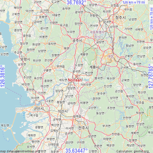
Nonsan GPS coordinates[2]
36° 12' 14.004" North, 127° 5' 4.992" East
| Map corner | latitude | longitude |
|---|---|---|
| Upper-left | 36.7692°, | 126.3816° |
| Center: | 36.20389°, | 127.08472° |
| Lower-right: | 35.63447°, | 127.78785° |
| Map W x H: | 126.2×126.2 km | = 78.4×78.4mi |
| max Lat: | 38.37881° ⇑44.8% North |
| Nonsan: | 36.20389° |
| min Lat: | ⇓55.2% South 33.25333° |
| min Long | Nonsan | max Long |
| 126.10863° | 127.08472° | 129.55377° |
| W 38.8%⇐ | ⇒61.2% E |
Elevation
Elevation of Nonsan is 16 m = 52 ft, and this is 54.4 m = 178 ft below average elevation for this country.
| Max E: |
691 m = 2267 ft | 80.8% |
| Avg. | 70.4 m = 231 ft | |
| Nonsan | 16 m = 52 ft | |
Min E: |
1 m = 3 ft | 19.2% |
See also: Nonsan elevation on elevation.city.
Geographical zone
Nonsan is located in North temperate zone (between Tropic of Cancer and the Arctic Circle). Distance of this Northern Tropic circle is 1419.6 km =882.1 mi to South.| Distance of | km | miles | from Nonsan |
|---|---|---|---|
| North Pole | 5981.6 | 3716.8 | to North |
| Arctic Circle | 3375.7 | 2097.6 | to North |
| Tropic Cancer | 1419.6 | 882.1 | to South |
| Equator | 4025.5 | 2501.3 | to South |


Nearby cities:
15 places around Nonsan: (largest is in red/bold)
• Buyeo
17.6 km =10.9 mi,  296°
296°
• Cheongnam
20.4 km =12.7 mi,  324°
324°
• Cheongyang
37.3 km =23.2 mi, 317°
• Daejeon
31.4 km =19.5 mi,  59°
59°
• Gongju
28.2 km =17.5 mi,  7°
7°
• Gunbuk
39.9 km =24.8 mi,  95°
95°
• Gyuam
19.7 km =12.2 mi,  293°
293°
• Iksan
31.2 km =19.4 mi,  202°
202°
• Jangpyeong
23 km =14.3 mi,  311°
311°
• Jinjam
23.4 km =14.5 mi, 62°
• Kinzan
38 km =23.6 mi,  107°
107°
• Sangwol
11.3 km =7 mi,  26°
26°
• Songgangdong
36.5 km =22.7 mi,  45°
45°
• Yuseong
28.1 km =17.5 mi, 53°
• Yŏnmu
8.4 km =5.2 mi,  170°
170°
Sources, notices
• [Note1] Compared only with cities in South Korea existing in our database
• [Src1] Map data: © OpenStreetMap contributors (CC-BY-SA)
• [Src2] Other city data from geonames.org with taken over terms of usage.
• [Src3] Geographical zone / Annual Mean Temperature by Robert A. Rohde @ Wikipedia
