Cheongyang geodata
Cheongyang (Chungcheongnam-do) is a seat of a second-order administrative division; located in South Korea in Asia/Seoul (GMT+9) time zone. In our database, there are 128 cities with bigger population. Compared to other cities in South Korea, 66.4% of cities are located further ↓South; 76.9% of cities are located further →East and 75.2% of cities have lower elevation than Cheongyang. Note1


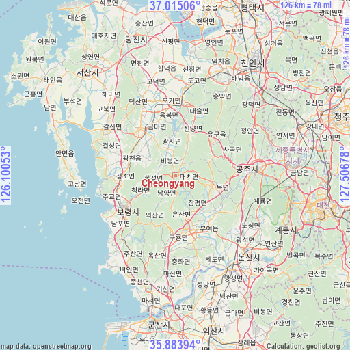
Cheongyang GPS coordinates[2]
36° 27' 5.616" North, 126° 48' 13.14" East
| Map corner | latitude | longitude |
|---|---|---|
| Upper-left | 37.01506°, | 126.10053° |
| Center: | 36.45156°, | 126.80365° |
| Lower-right: | 35.88394°, | 127.50678° |
| Map W x H: | 125.8×125.8 km | = 78.2×78.2mi |
| max Lat: | 38.37881° ⇑33.6% North |
| Cheongyang: | 36.45156° |
| min Lat: | ⇓66.4% South 33.25333° |
| min Long | Cheongyang | max Long |
| 126.10863° | 126.80365° | 129.55377° |
| W 23.1%⇐ | ⇒76.9% E |
Elevation
Elevation of Cheongyang is 93 m = 305 ft, and this is 22.6 m = 74 ft above average elevation for this country.
| Max E: |
691 m = 2267 ft | 24.8% |
| Cheongyang | 93 m 305 ft | |
| Avg. | 70.4 m = 231 ft | |
Min E: |
1 m = 3 ft | 75.2% |
See also: South Korea elevation on elevation.city.
Geographical zone
Cheongyang is located in North temperate zone (between Tropic of Cancer and the Arctic Circle). Distance of this Northern Tropic circle is 1447.1 km =899.2 mi to South.| Distance of | km | miles | from Cheongyang |
|---|---|---|---|
| North Pole | 5954 | 3699.6 | to North |
| Arctic Circle | 3348.1 | 2080.4 | to North |
| Tropic Cancer | 1447.1 | 899.2 | to South |
| Equator | 4053 | 2518.4 | to South |


Nearby cities:
15 places around Cheongyang: (largest is in red/bold)
• Asan
41 km =25.5 mi,  25°
25°
• Biin
39 km =24.2 mi,  207°
207°
• Boryeong
21.7 km =13.5 mi,  238°
238°
• Buyeo
21.8 km =13.5 mi,  154°
154°
• Cheongnam
17.2 km =10.7 mi,  129°
129°
• Gongju
28.7 km =17.8 mi,  89°
89°
• Gyuam
20.9 km =13 mi,  159°
159°
• Hongseong
20.7 km =12.9 mi,  323°
323°
• Jangpyeong
14.6 km =9.1 mi, 146°
• Nonsan
37.3 km =23.2 mi,  137°
137°
• Sangwol
34.9 km =21.7 mi,  119°
119°
• Sejong
46.4 km =28.8 mi,  70°
70°
• Seosan
48.3 km =30 mi, 319°
• Yesan
25.4 km =15.8 mi,  7°
7°
• Yŏnmu
44.6 km =27.7 mi, 143°
Sources, notices
• [Note1] Compared only with cities in South Korea existing in our database
• [Src1] Map data: © OpenStreetMap contributors (CC-BY-SA)
• [Src2] Other city data from geonames.org with taken over terms of usage.
• [Src3] Geographical zone / Annual Mean Temperature by Robert A. Rohde @ Wikipedia
