Goyang-si geodata
Goyang-si (Gyeonggi-do) is a populated place; located in South Korea in Asia/Seoul (GMT+9) time zone. With population of 1,073,069 people, there are 7 cities with bigger population in this country. Compared to other cities in South Korea, 83.9% of cities are located further ↓South; 75.2% of cities are located further →East and 73.4% of cities have higher elevation than Goyang-si. Note1


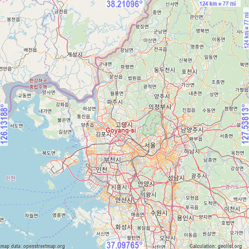
Goyang-si GPS coordinates[2]
37° 39' 23.004" North, 126° 50' 6" East
| Map corner | latitude | longitude |
|---|---|---|
| Upper-left | 38.21096°, | 126.13188° |
| Center: | 37.65639°, | 126.835° |
| Lower-right: | 37.09765°, | 127.53813° |
| Map W x H: | 123.8×123.8 km | = 76.9×76.9mi |
| max Lat: | 38.37881° ⇑16.1% North |
| Goyang-si: | 37.65639° |
| min Lat: | ⇓83.9% South 33.25333° |
| min Long | Goyang-si | max Long |
| 126.10863° | 126.835° | 129.55377° |
| W 24.8%⇐ | ⇒75.2% E |
Elevation
Elevation of Goyang-si is 19 m = 62 ft, and this is 51.4 m = 169 ft below average elevation for this country.
| Max E: |
691 m = 2267 ft | 73.4% |
| Avg. | 70.4 m = 231 ft | |
| Goyang-si | 19 m = 62 ft | |
Min E: |
1 m = 3 ft | 26.6% |
See also: Goyang-si elevation on elevation.city.
Geographical zone
Goyang-si is located in North temperate zone (between Tropic of Cancer and the Arctic Circle). Distance of this Northern Tropic circle is 1581.1 km =982.4 mi to South.| Distance of | km | miles | from Goyang-si |
|---|---|---|---|
| North Pole | 5820.1 | 3616.4 | to North |
| Arctic Circle | 3214.2 | 1997.2 | to North |
| Tropic Cancer | 1581.1 | 982.4 | to South |
| Equator | 4187 | 2601.7 | to South |


Nearby cities:
15 places around Goyang-si: (largest is in red/bold)
• Beobwon
21.7 km =13.5 mi,  9°
9°
• Bucheon-si
18.1 km =11.2 mi,  194°
194°
• Bupyeong
19.5 km =12.1 mi,  210°
210°
• Gwangjeok
22.9 km =14.2 mi,  34°
34°
• Gwangtan
13.9 km =8.6 mi, 5°
• Haseong
19.3 km =12 mi,  291°
291°
• Jangheung
11.5 km =7.1 mi,  54°
54°
• Kwangmyŏng
20.1 km =12.5 mi,  172°
172°
• Paju
19.7 km =12.2 mi,  355°
355°
• Paripark
14 km =8.7 mi,  164°
164°
• Seoul
16.1 km =10 mi,  128°
128°
• Tanhyeon
19.3 km =12 mi,  327°
327°
• Tongjin
21.2 km =13.2 mi,  280°
280°
• Uijeongbu-si
20.9 km =13 mi,  63°
63°
• Yongsan-dong
18.1 km =11.2 mi, 133°
Sources, notices
• [Note1] Compared only with cities in South Korea existing in our database
• [Src1] Map data: © OpenStreetMap contributors (CC-BY-SA)
• [Src2] Other city data from geonames.org with taken over terms of usage.
• [Src3] Geographical zone / Annual Mean Temperature by Robert A. Rohde @ Wikipedia
