Hwayang geodata
Hwayang (Jeollanam-do) is a seat of a third-order administrative division; located in South Korea in Asia/Seoul (GMT+9) time zone. In our database, there are 128 cities with bigger population. Compared to other cities in South Korea, 98.3% of cities are located further ↑North; 65% of cities are located further ←West and 89.9% of cities have higher elevation than Hwayang. Note1


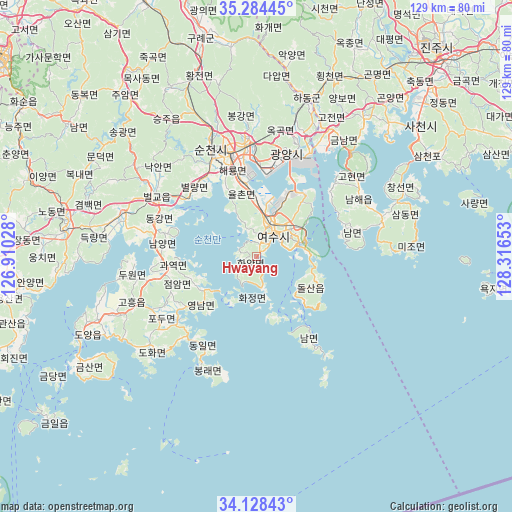
Hwayang GPS coordinates[2]
34° 42' 30.456" North, 127° 36' 48.24" East
| Map corner | latitude | longitude |
|---|---|---|
| Upper-left | 35.28445°, | 126.91028° |
| Center: | 34.70846°, | 127.6134° |
| Lower-right: | 34.12843°, | 128.31653° |
| Map W x H: | 128.5×128.5 km | = 79.8×79.8mi |
| max Lat: | 38.37881° ⇑98.3% North |
| Hwayang: | 34.70846° |
| min Lat: | ⇓1.7% South 33.25333° |
| min Long | Hwayang | max Long |
| 126.10863° | 127.6134° | 129.55377° |
| W 65%⇐ | ⇒35% E |
Elevation
Elevation of Hwayang is 11 m = 36 ft, and this is 59.4 m = 195 ft below average elevation for this country.
| Max E: |
691 m = 2267 ft | 89.9% |
| Avg. | 70.4 m = 231 ft | |
| Hwayang | 11 m = 36 ft | |
Min E: |
1 m = 3 ft | 10.1% |
See also: South Korea elevation on elevation.city.
Geographical zone
Hwayang is located in North temperate zone (between Tropic of Cancer and the Arctic Circle). Distance of this Northern Tropic circle is 1253.3 km =778.8 mi to South.| Distance of | km | miles | from Hwayang |
|---|---|---|---|
| North Pole | 6147.8 | 3820.1 | to North |
| Arctic Circle | 3542 | 2200.9 | to North |
| Tropic Cancer | 1253.3 | 778.8 | to South |
| Equator | 3859.2 | 2398 | to South |


Nearby cities:
15 places around Hwayang: (largest is in red/bold)
• Beolgyo
29.4 km =18.3 mi,  302°
302°
• Byeollyang
23.7 km =14.7 mi,  321°
321°
• Donggang
26.8 km =16.7 mi,  287°
287°
• Geumseong
32.7 km =20.3 mi,  29°
29°
• Gwangyang
27 km =16.8 mi,  16°
16°
• Haeryong
23.9 km =14.9 mi,  343°
343°
• Jinwol
32.9 km =20.4 mi, 23°
• Kwangyang
29.7 km =18.5 mi,  355°
355°
• Nammyeon
26 km =16.2 mi,  74°
74°
• Okgok
32.3 km =20.1 mi,  13°
13°
• Sangsa
29.5 km =18.3 mi,  330°
330°
• Sora
9.6 km =6 mi, 10°
• Suncheon
29.3 km =18.2 mi, 336°
• Yeosu
7.3 km =4.5 mi,  37°
37°
• Yulchon
19.6 km =12.2 mi,  350°
350°
Sources, notices
• [Note1] Compared only with cities in South Korea existing in our database
• [Src1] Map data: © OpenStreetMap contributors (CC-BY-SA)
• [Src2] Other city data from geonames.org with taken over terms of usage.
• [Src3] Geographical zone / Annual Mean Temperature by Robert A. Rohde @ Wikipedia
