Salaspils geodata
Salaspils is a seat of a first-order administrative division; located in Latvia in Europe/Riga (GMT+3) time zone. With population of 17,606 people, there are 12 cities with bigger population in this country. Compared to other cities in Latvia, 54.3% of cities are located further ↑North; 56.4% of cities are located further →East and 76.4% of cities have higher elevation than Salaspils. Note1


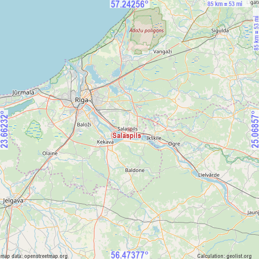
Salaspils GPS coordinates[2]
56° 51' 36.504" North, 24° 21' 55.584" East
| Map corner | latitude | longitude |
|---|---|---|
| Upper-left | 57.24256°, | 23.66232° |
| Center: | 56.86014°, | 24.36544° |
| Lower-right: | 56.47377°, | 25.06857° |
| Map W x H: | 85.5×85.5 km | = 53.1×53.1mi |
| max Lat: | 57.89752° ⇑54.3% North |
| Salaspils: | 56.86014° |
| min Lat: | ⇓45.7% South 55.75284° |
| min Long | Salaspils | max Long |
| 21.01085° | 24.36544° | 28.12165° |
| W 43.6%⇐ | ⇒56.4% E |
Elevation
Elevation of Salaspils is 21 m = 69 ft, and this is 44.4 m = 146 ft below average elevation for this country.
| Max E: |
212 m = 696 ft | 76.4% |
| Avg. | 65.4 m = 215 ft | |
| Salaspils | 21 m = 69 ft | |
Min E: |
2 m = 7 ft | 23.6% |
See also: Latvia elevation on elevation.city.
Geographical zone
Salaspils is located in North temperate zone (between Tropic of Cancer and the Arctic Circle). Distance of this North polar circle is 1078.9 km =670.4 mi to North.| Distance of | km | miles | from Salaspils |
|---|---|---|---|
| North Pole | 3684.8 | 2289.6 | to North |
| Arctic Circle | 1078.9 | 670.4 | to North |
| Tropic Cancer | 3716.3 | 2309.2 | to South |
| Equator | 6322.3 | 3928.5 | to South |


Nearby cities:
15 places around Salaspils: (largest is in red/bold)
• Baldone
13 km =8.1 mi,  170°
170°
• Baloži
15.1 km =9.4 mi,  276°
276°
• Berģi
14.6 km =9.1 mi,  344°
344°
• Garkalne
20.8 km =12.9 mi,  9°
9°
• Ikšķile
8.5 km =5.3 mi,  110°
110°
• Jaunciems
23 km =14.3 mi,  329°
329°
• Mežaparks
19.9 km =12.4 mi,  321°
321°
• Mārupe
19.7 km =12.2 mi, 284°
• Ogre
15.9 km =9.9 mi, 107°
• Riga
18.4 km =11.4 mi,  301°
301°
• Ropaži
20.6 km =12.8 mi,  51°
51°
• Ulbroka
9.3 km =5.8 mi, 336°
• Ādaži
23.4 km =14.5 mi,  355°
355°
• Ķegums
25.3 km =15.7 mi,  120°
120°
• Ķekava
9 km =5.6 mi,  245°
245°
Sources, notices
• [Note1] Compared only with cities in Latvia existing in our database
• [Src1] Map data: © OpenStreetMap contributors (CC-BY-SA)
• [Src2] Other city data from geonames.org with taken over terms of usage.
• [Src3] Geographical zone / Annual Mean Temperature by Robert A. Rohde @ Wikipedia
