Sidi Abdallah Ghiat geodata
Sidi Abdallah Ghiat is a seat of a third-order administrative division; located in Morocco in Africa/Casablanca (GMT+1) time zone. In our database, there are 108 cities with bigger population. Compared to other cities in Morocco, 73.3% of cities are located further ↑North; 75.6% of cities are located further →East and 56.2% of cities have lower elevation than Sidi Abdallah Ghiat. Note1


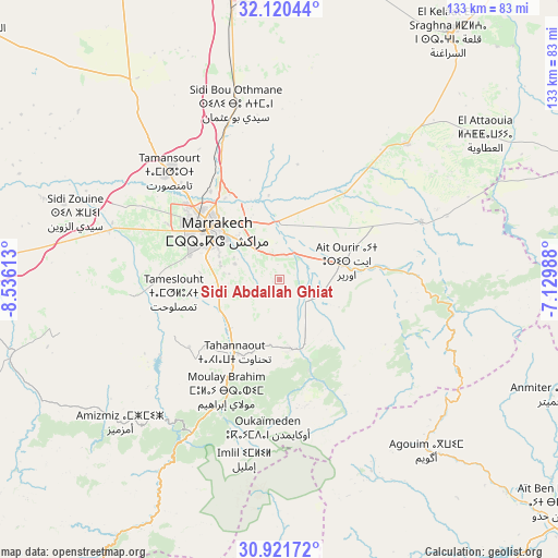
Sidi Abdallah Ghiat GPS coordinates[2]
31° 31' 22.8" North, 7° 49' 58.8" West
| Map corner | latitude | longitude |
|---|---|---|
| Upper-left | 32.12044°, | -8.53613° |
| Center: | 31.523°, | -7.833° |
| Lower-right: | 30.92172°, | -7.12988° |
| Map W x H: | 133.3×133.3 km | = 82.8×82.8mi |
| max Lat: | 35.84906° ⇑73.3% North |
| Sidi Abdallah Ghiat: | 31.523° |
| min Lat: | ⇓26.7% South 22.6558° |
| min Long | Sidi Abdallah G | max Long |
| -15.60719° | -7.833° | -1.22855° |
| W 24.4%⇐ | ⇒75.6% E |
Elevation
Elevation of Sidi Abdallah Ghiat is 581 m = 1906 ft, and this is 35.8 m = 117 ft below average elevation for this country.
| Max E: |
2637 m = 8652 ft | 43.8% |
| Avg. | 616.8 m = 2024 ft | |
| Sidi Abdallah Ghiat | 581 m = 1906 ft | |
Min E: |
1 m = 3 ft | 56.2% |
See also: Morocco elevation on elevation.city.
Geographical zone
Sidi Abdallah Ghiat is located in North temperate zone (between Tropic of Cancer and the Arctic Circle). Distance of this Northern Tropic circle is 899.1 km =558.7 mi to South.| Distance of | km | miles | from Sidi Abdallah Ghiat |
|---|---|---|---|
| North Pole | 6502 | 4040.2 | to North |
| Arctic Circle | 3896.1 | 2420.9 | to North |
| Tropic Cancer | 899.1 | 558.7 | to South |
| Equator | 3505 | 2177.9 | to South |


Nearby cities:
15 places around Sidi Abdallah Ghiat: (largest is in red/bold)
• Abadou
49.7 km =30.9 mi,  82°
82°
• Amizmiz
50.9 km =31.6 mi,  228°
228°
• Azgour
62.7 km =39 mi, 226°
• Iguidi
76.4 km =47.5 mi,  184°
184°
• Marrakesh
20.1 km =12.5 mi,  308°
308°
• Moulay Brahim
29.1 km =18.1 mi,  206°
206°
• Oukaïmedene
35.3 km =21.9 mi, 184°
• Setti Fatma
36.3 km =22.6 mi,  155°
155°
• Sidi Bou Othmane
43.4 km =27 mi,  346°
346°
• Sidi Rahhal
36.9 km =22.9 mi,  67°
67°
• Telouet
62.2 km =38.6 mi,  114°
114°
• Tidili Mesfioua
21.9 km =13.6 mi, 106°
• Tizguine
56.4 km =35 mi, 234°
• Touama
32.3 km =20.1 mi,  87°
87°
• Zerkten
42.7 km =26.5 mi,  101°
101°
Sources, notices
• [Note1] Compared only with cities in Morocco existing in our database
• [Src1] Map data: © OpenStreetMap contributors (CC-BY-SA)
• [Src2] Other city data from geonames.org with taken over terms of usage.
• [Src3] Geographical zone / Annual Mean Temperature by Robert A. Rohde @ Wikipedia
