Iguidi geodata
Iguidi (Souss-Massa) is a seat of a third-order administrative division; located in Morocco in Africa/Casablanca (GMT+1) time zone. In our database, there are 108 cities with bigger population. Compared to other cities in Morocco, 84.1% of cities are located further ↑North; 76.4% of cities are located further →East and 86% of cities have lower elevation than Iguidi. Note1


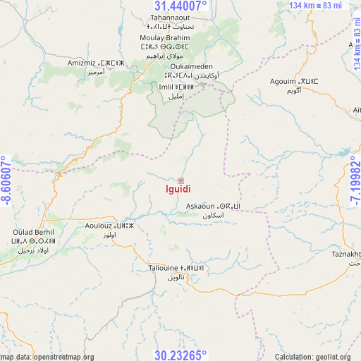
Iguidi GPS coordinates[2]
30° 50' 17.736" North, 7° 54' 10.584" West
| Map corner | latitude | longitude |
|---|---|---|
| Upper-left | 31.44007°, | -8.60607° |
| Center: | 30.83826°, | -7.90294° |
| Lower-right: | 30.23265°, | -7.19982° |
| Map W x H: | 134.3×134.3 km | = 83.5×83.5mi |
| max Lat: | 35.84906° ⇑84.1% North |
| Iguidi: | 30.83826° |
| min Lat: | ⇓15.9% South 22.6558° |
| min Long | Iguidi | max Long |
| -15.60719° | -7.90294° | -1.22855° |
| W 23.6%⇐ | ⇒76.4% E |
Elevation
Elevation of Iguidi is 1218 m = 3996 ft, and this is 601.2 m = 1972 ft above average elevation for this country.
| Max E: |
2637 m = 8652 ft | 14% |
| Iguidi | 1218 m 3996 ft | |
| Avg. | 616.8 m = 2024 ft | |
Min E: |
1 m = 3 ft | 86% |
See also: Morocco elevation on elevation.city.
Geographical zone
Iguidi is located in North temperate zone (between Tropic of Cancer and the Arctic Circle). Distance of this Northern Tropic circle is 823 km =511.4 mi to South.| Distance of | km | miles | from Iguidi |
|---|---|---|---|
| North Pole | 6578.2 | 4087.5 | to North |
| Arctic Circle | 3972.3 | 2468.3 | to North |
| Tropic Cancer | 823 | 511.4 | to South |
| Equator | 3428.9 | 2130.6 | to South |


Nearby cities:
15 places around Iguidi: (largest is in red/bold)
• Adassil
63.6 km =39.5 mi,  298°
298°
• Agadir Melloul
69 km =42.9 mi,  171°
171°
• Amerzgane
69.9 km =43.4 mi,  70°
70°
• Amizmiz
52.5 km =32.6 mi,  323°
323°
• Aoulouz
32.3 km =20.1 mi,  235°
235°
• Azgour
51.5 km =32 mi,  310°
310°
• Moulay Brahim
50.4 km =31.3 mi,  352°
352°
• Oukaïmedene
41.1 km =25.5 mi,  5°
5°
• Setti Fatma
48.1 km =29.9 mi,  26°
26°
• Sidi Abdallah Ghiat
76.4 km =47.5 mi,  4°
4°
• Taliouine
34.4 km =21.4 mi,  181°
181°
• Taznakht
72.9 km =45.3 mi,  113°
113°
• Tidili Mesfioua
75.1 km =46.7 mi,  21°
21°
• Tizguine
58.6 km =36.4 mi, 317°
• Zawit Al Bour
31.7 km =19.7 mi,  234°
234°
Sources, notices
• [Note1] Compared only with cities in Morocco existing in our database
• [Src1] Map data: © OpenStreetMap contributors (CC-BY-SA)
• [Src2] Other city data from geonames.org with taken over terms of usage.
• [Src3] Geographical zone / Annual Mean Temperature by Robert A. Rohde @ Wikipedia
