Attard geodata
Attard is a seat of a first-order administrative division; located in Malta in Europe/Malta (GMT+2) time zone. With population of 9,510 people, there are 13 cities with bigger population in this country. Compared to other cities in Malta, 59.2% of cities are located further ↑North; 62% of cities are located further →East and 50.7% of cities have higher elevation than Attard. Note1


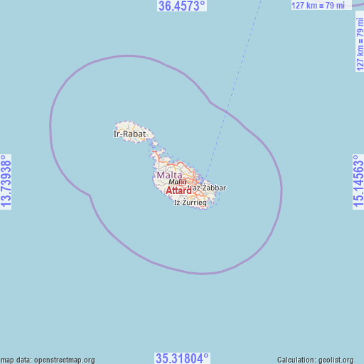
Attard GPS coordinates[2]
35° 53' 22.992" North, 14° 26' 33" East
| Map corner | latitude | longitude |
|---|---|---|
| Upper-left | 36.4573°, | 13.73938° |
| Center: | 35.88972°, | 14.4425° |
| Lower-right: | 35.31804°, | 15.14563° |
| Map W x H: | 126.7×126.7 km | = 78.7×78.7mi |
| max Lat: | 36.07222° ⇑59.2% North |
| Attard: | 35.88972° |
| min Lat: | ⇓40.8% South 35.82583° |
| min Long | Attard | max Long |
| 14.20361° | 14.4425° | 14.56701° |
| W 38%⇐ | ⇒62% E |
Elevation
Elevation of Attard is 69 m = 226 ft, and this is 9.1 m = 30 ft below average elevation for this country.
| Max E: |
231 m = 758 ft | 50.7% |
| Avg. | 78.1 m = 256 ft | |
| Attard | 69 m = 226 ft | |
Min E: |
5 m = 16 ft | 49.3% |
See also: Malta elevation on elevation.city.
Geographical zone
Attard is located in North temperate zone (between Tropic of Cancer and the Arctic Circle). Distance of this Northern Tropic circle is 1384.6 km =860.4 mi to South.| Distance of | km | miles | from Attard |
|---|---|---|---|
| North Pole | 6016.5 | 3738.5 | to North |
| Arctic Circle | 3410.6 | 2119.2 | to North |
| Tropic Cancer | 1384.6 | 860.4 | to South |
| Equator | 3990.6 | 2479.6 | to South |


Nearby cities:
15 places around Attard: (largest is in red/bold)
• Balzan
1.6 km =1 mi,  43°
43°
• Birkirkara
1.9 km =1.2 mi,  63°
63°
• Hal Gharghur
3.9 km =2.4 mi,  11°
11°
• Haz-Zebbug
2 km =1.2 mi,  183°
183°
• Imdina
3.6 km =2.2 mi,  265°
265°
• Imsida
3.6 km =2.2 mi,  85°
85°
• L-Iklin
1.9 km =1.2 mi,  33°
33°
• Lija
1.3 km =0.8 mi,  16°
16°
• Mosta
2.6 km =1.6 mi,  324°
324°
• Naxxar
2.7 km =1.7 mi,  2°
2°
• Qormi
3.1 km =1.9 mi,  119°
119°
• Saint John
3.5 km =2.2 mi, 59°
• Santa Venera
2.9 km =1.8 mi, 87°
• Siġġiewi
3.8 km =2.4 mi,  188°
188°
• Ħamrun
3.8 km =2.4 mi,  98°
98°
Sources, notices
• [Note1] Compared only with cities in Malta existing in our database
• [Src1] Map data: © OpenStreetMap contributors (CC-BY-SA)
• [Src2] Other city data from geonames.org with taken over terms of usage.
• [Src3] Geographical zone / Annual Mean Temperature by Robert A. Rohde @ Wikipedia
