Qormi geodata
Qormi is a seat of a first-order administrative division; located in Malta in Europe/Malta (GMT+2) time zone. With population of 18,230 people, there is 1 city with bigger population in this country. Compared to other cities in Malta, 73.2% of cities are located further ↑North; 50.7% of cities are located further ←West and 74.6% of cities have higher elevation than Qormi. Note1


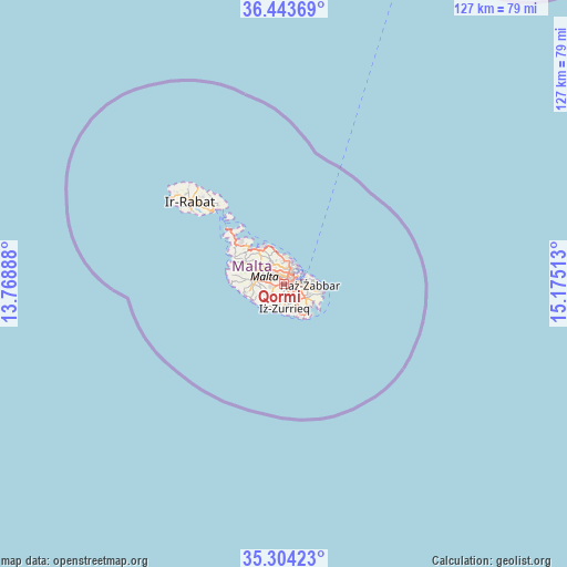
Qormi GPS coordinates[2]
35° 52' 33.636" North, 14° 28' 19.2" East
| Map corner | latitude | longitude |
|---|---|---|
| Upper-left | 36.44369°, | 13.76888° |
| Center: | 35.87601°, | 14.472° |
| Lower-right: | 35.30423°, | 15.17513° |
| Map W x H: | 126.7×126.7 km | = 78.7×78.7mi |
| max Lat: | 36.07222° ⇑73.2% North |
| Qormi: | 35.87601° |
| min Lat: | ⇓26.8% South 35.82583° |
| min Long | Qormi | max Long |
| 14.20361° | 14.472° | 14.56701° |
| W 50.7%⇐ | ⇒49.3% E |
Elevation
Elevation of Qormi is 41 m = 135 ft, and this is 37.1 m = 122 ft below average elevation for this country.
| Max E: |
231 m = 758 ft | 74.6% |
| Avg. | 78.1 m = 256 ft | |
| Qormi | 41 m = 135 ft | |
Min E: |
5 m = 16 ft | 25.4% |
See also: Malta elevation on elevation.city.
Geographical zone
Qormi is located in North temperate zone (between Tropic of Cancer and the Arctic Circle). Distance of this Northern Tropic circle is 1383.1 km =859.4 mi to South.| Distance of | km | miles | from Qormi |
|---|---|---|---|
| North Pole | 6018 | 3739.4 | to North |
| Arctic Circle | 3412.1 | 2120.2 | to North |
| Tropic Cancer | 1383.1 | 859.4 | to South |
| Equator | 3989 | 2478.6 | to South |


Nearby cities:
15 places around Qormi: (largest is in red/bold)
• Attard
3.1 km =1.9 mi,  299°
299°
• Balzan
3.1 km =1.9 mi,  330°
330°
• Birkirkara
2.6 km =1.6 mi,  337°
337°
• Haz-Zebbug
2.8 km =1.7 mi,  260°
260°
• Imsida
2.1 km =1.3 mi,  27°
27°
• Luqa
2.4 km =1.5 mi,  141°
141°
• Marsa
2.1 km =1.3 mi,  80°
80°
• Mqabba
3.2 km =2 mi,  186°
186°
• Paola
2.4 km =1.5 mi,  97°
97°
• Pietà
2.9 km =1.8 mi,  44°
44°
• Saint John
3.3 km =2.1 mi,  6°
6°
• Santa Luċija
3.5 km =2.2 mi,  114°
114°
• Santa Venera
1.7 km =1.1 mi, 6°
• Ta’ Xbiex
3.3 km =2.1 mi, 38°
• Ħamrun
1.5 km =0.9 mi,  49°
49°
Sources, notices
• [Note1] Compared only with cities in Malta existing in our database
• [Src1] Map data: © OpenStreetMap contributors (CC-BY-SA)
• [Src2] Other city data from geonames.org with taken over terms of usage.
• [Src3] Geographical zone / Annual Mean Temperature by Robert A. Rohde @ Wikipedia
