Vingt Cinq geodata
Vingt Cinq (Agalega Islands) is a seat of a first-order administrative division; located in Mauritius in Indian/Mauritius (GMT+4) time zone. With population of 250 people, there are 98 cities with bigger population in this country. Compared to other cities in Mauritius, 100% of cities are located further ↓South; 100% of cities are located further →East and 97% of cities have higher elevation than Vingt Cinq. Note1


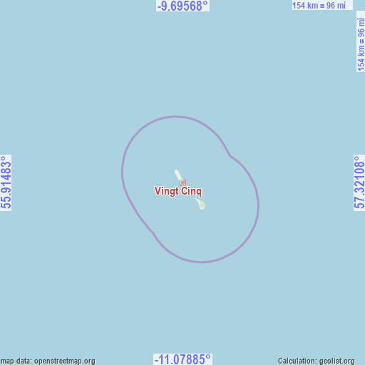
Vingt Cinq GPS coordinates[2]
10° 23' 16.908" South, 56° 37' 4.62" East
| Map corner | latitude | longitude |
|---|---|---|
| Upper-left | -9.69568°, | 55.91483° |
| Center: | -10.38803°, | 56.61795° |
| Lower-right: | -11.07885°, | 57.32108° |
| Map W x H: | 153.8×153.8 km | = 95.6×95.6mi |
| max Lat: | -10.38803° ⇑0% North |
| Vingt Cinq: | -10.38803° |
| min Lat: | ⇓100% South -20.51667° |
| min Long | Vingt Cinq | max Long |
| 56.61795° | 56.61795° | 63.41667° |
| W 0%⇐ | ⇒100% E |
Elevation
Elevation of Vingt Cinq is 4 m = 13 ft, and this is 148.1 m = 486 ft below average elevation for this country.
| Max E: |
467 m = 1532 ft | 97% |
| Avg. | 152.1 m = 499 ft | |
| Vingt Cinq | 4 m = 13 ft | |
Min E: |
1 m = 3 ft | 3% |
See also: Mauritius elevation on elevation.city.
Geographical zone
Vingt Cinq is located in South Torrid zone (between Equator and Tropic of Capricorn). Distance of Equator is 1155 km =717.7 mi to North.| Distance of | km | miles | from Vingt Cinq |
|---|---|---|---|
| Equator | 1155 | 717.7 | to North |
| Tropic Capricorn | 1450.9 | 901.5 | to South |
| Antarctic Circle | 6246.1 | 3881.1 | to South |
| South Pole | 8852 | 5500.4 | to South |


Nearby cities:
15 places around Vingt Cinq: (largest is in red/bold)
• Cap Malheureux
1072.3 km =666.3 mi,  174°
174°
• Cargados Carajos
765.2 km =475.5 mi,  154°
154°
• Cottage
1080.8 km =671.6 mi, 174°
• Espérance Trébuchet
1082.1 km =672.4 mi, 174°
• Fond du Sac
1079 km =670.5 mi, 174°
• Goodlands
1078.7 km =670.3 mi, 174°
• Grand Baie
1075.7 km =668.4 mi, 174°
• Grand Gaube
1075.3 km =668.2 mi, 174°
• Morcellement Saint André
1081.6 km =672.1 mi, 174°
• Petit Raffray
1076.4 km =668.8 mi, 174°
• Plaine des Papayes
1080.8 km =671.6 mi, 174°
• Pointe aux Piments
1080.3 km =671.3 mi, 174°
• Roche Terre
1076.5 km =668.9 mi, 174°
• The Vale
1077.3 km =669.4 mi, 174°
• Triolet
1079.8 km =671 mi, 174°
Sources, notices
• [Note1] Compared only with cities in Mauritius existing in our database
• [Src1] Map data: © OpenStreetMap contributors (CC-BY-SA)
• [Src2] Other city data from geonames.org with taken over terms of usage.
• [Src3] Geographical zone / Annual Mean Temperature by Robert A. Rohde @ Wikipedia
