Tanque Blanco geodata
Tanque Blanco (Tamaulipas) is a populated place; located in Mexico in America/Monterrey (GMT-6) time zone. With population of 628 people, there are 13781 cities with bigger population in this country. Compared to other cities in Mexico, 87.9% of cities are located further ↓South; 61.1% of cities are located further →East and 57.7% of cities have higher elevation than Tanque Blanco. Note1


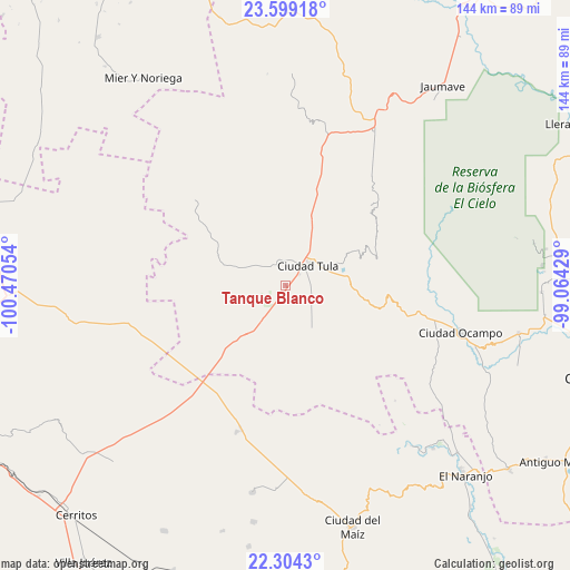
Tanque Blanco GPS coordinates[2]
22° 57' 11.844" North, 99° 46' 2.676" West
| Map corner | latitude | longitude |
|---|---|---|
| Upper-left | 23.59918°, | -100.47054° |
| Center: | 22.95329°, | -99.76741° |
| Lower-right: | 22.3043°, | -99.06429° |
| Map W x H: | 144×144 km | = 89.5×89.5mi |
| max Lat: | 32.7° ⇑12.1% North |
| Tanque Blanco: | 22.95329° |
| min Lat: | ⇓87.9% South 14.53588° |
| min Long | Tanque Blanco | max Long |
| -117.105° | -99.76741° | -86.73105° |
| W 38.9%⇐ | ⇒61.1% E |
Elevation
Elevation of Tanque Blanco is 1110 m = 3642 ft, and this is 143.7 m = 471 ft below average elevation for this country.
| Max E: |
3497 m = 11473 ft | 57.7% |
| Avg. | 1253.7 m = 4113 ft | |
| Tanque Blanco | 1110 m = 3642 ft | |
Min E: |
-1 m = -3 ft | 42.3% |
See also: Mexico elevation on elevation.city.
Geographical zone
Tanque Blanco is located in North Torrid zone (between Equator and Tropic of Cancer). Distance of this Northern Tropic circle is 53.8 km =33.4 mi to North.| Distance of | km | miles | from Tanque Blanco |
|---|---|---|---|
| North Pole | 7454.9 | 4632.3 | to North |
| Arctic Circle | 4849 | 3013 | to North |
| Tropic Cancer | 53.8 | 33.4 | to North |
| Equator | 2552.2 | 1585.9 | to South |


Nearby cities:
15 places around Tanque Blanco: (largest is in red/bold)
• Calabacillas
29.7 km =18.5 mi,  6°
6°
• Ciudad Tula
7.6 km =4.7 mi,  49°
49°
• El Aguacate
42 km =26.1 mi,  0°
0°
• El Custodio
39.4 km =24.5 mi,  211°
211°
• Emiliano Zapata
30.6 km =19 mi,  225°
225°
• Lázaro Cárdenas
29.4 km =18.3 mi,  273°
273°
• Magdaleno Cedillo
25.3 km =15.7 mi,  223°
223°
• Negritas
44 km =27.3 mi,  246°
246°
• Palmillas
44.8 km =27.8 mi,  29°
29°
• Ricardo Flores Magon
44.2 km =27.5 mi,  124°
124°
• Salitrillo
24.2 km =15 mi,  345°
345°
• San Rafael
19.2 km =11.9 mi, 351°
• San Rafael Matriz
39.1 km =24.3 mi,  198°
198°
• Santa Ana de Nahola
11.4 km =7.1 mi,  292°
292°
• Álvaro Obregón
25.7 km =16 mi,  17°
17°
Sources, notices
• [Note1] Compared only with cities in Mexico existing in our database
• [Src1] Map data: © OpenStreetMap contributors (CC-BY-SA)
• [Src2] Other city data from geonames.org with taken over terms of usage.
• [Src3] Geographical zone / Annual Mean Temperature by Robert A. Rohde @ Wikipedia
