San Rafael geodata
San Rafael (Tamaulipas) is a populated place; located in Mexico in America/Monterrey (GMT-6) time zone. With population of 508 people, there are 16554 cities with bigger population in this country. Compared to other cities in Mexico, 88.2% of cities are located further ↓South; 61.4% of cities are located further →East and 54.9% of cities have higher elevation than San Rafael. Note1


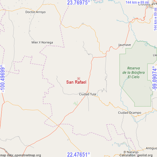
San Rafael GPS coordinates[2]
23° 7' 28.884" North, 99° 47' 37.896" West
| Map corner | latitude | longitude |
|---|---|---|
| Upper-left | 23.76975°, | -100.49699° |
| Center: | 23.12469°, | -99.79386° |
| Lower-right: | 22.47651°, | -99.09074° |
| Map W x H: | 143.8×143.8 km | = 89.4×89.4mi |
| max Lat: | 32.7° ⇑11.8% North |
| San Rafael: | 23.12469° |
| min Lat: | ⇓88.2% South 14.53588° |
| min Long | San Rafael | max Long |
| -117.105° | -99.79386° | -86.73105° |
| W 38.6%⇐ | ⇒61.4% E |
Elevation
Elevation of San Rafael is 1200 m = 3937 ft, and this is 53.7 m = 176 ft below average elevation for this country.
| Max E: |
3497 m = 11473 ft | 54.9% |
| Avg. | 1253.7 m = 4113 ft | |
| San Rafael | 1200 m = 3937 ft | |
Min E: |
-1 m = -3 ft | 45.1% |
See also: Mexico elevation on elevation.city.
Geographical zone
San Rafael is located in North Torrid zone (between Equator and Tropic of Cancer). Distance of this Northern Tropic circle is 34.7 km =21.6 mi to North.| Distance of | km | miles | from San Rafael |
|---|---|---|---|
| North Pole | 7435.8 | 4620.4 | to North |
| Arctic Circle | 4829.9 | 3001.2 | to North |
| Tropic Cancer | 34.7 | 21.6 | to North |
| Equator | 2571.2 | 1597.7 | to South |


Nearby cities:
15 places around San Rafael: (largest is in red/bold)
• Bustamante
34.7 km =21.6 mi,  5°
5°
• Calabacillas
12.1 km =7.5 mi,  30°
30°
• Ciudad Tula
16.5 km =10.3 mi,  149°
149°
• El Aguacate
23.2 km =14.4 mi, 7°
• Emiliano Zapata
44.8 km =27.8 mi,  205°
205°
• Felipe Ángeles
29.6 km =18.4 mi, 7°
• La Cardona
36.4 km =22.6 mi,  328°
328°
• Lázaro Cárdenas
31.6 km =19.6 mi,  237°
237°
• Magdaleno Cedillo
40.2 km =25 mi,  201°
201°
• Palmillas
31.9 km =19.8 mi,  51°
51°
• Salitrillo
5.6 km =3.5 mi,  321°
321°
• San Ignacio
40 km =24.9 mi,  280°
280°
• Santa Ana de Nahola
16.7 km =10.4 mi, 208°
• Tanque Blanco
19.2 km =11.9 mi,  171°
171°
• Álvaro Obregón
11.6 km =7.2 mi,  61°
61°
Sources, notices
• [Note1] Compared only with cities in Mexico existing in our database
• [Src1] Map data: © OpenStreetMap contributors (CC-BY-SA)
• [Src2] Other city data from geonames.org with taken over terms of usage.
• [Src3] Geographical zone / Annual Mean Temperature by Robert A. Rohde @ Wikipedia
