San Rafael Matriz geodata
San Rafael Matriz (San Luis Potosí) is a populated place; located in Mexico in America/Mexico_City (GMT-6) time zone. With population of 542 people, there are 15673 cities with bigger population in this country. Compared to other cities in Mexico, 87.1% of cities are located further ↓South; 62.5% of cities are located further →East and 59.6% of cities have higher elevation than San Rafael Matriz. Note1


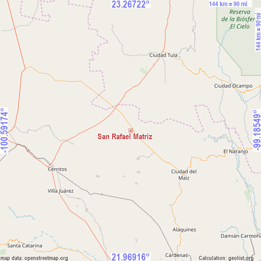
San Rafael Matriz GPS coordinates[2]
22° 37' 10.992" North, 99° 53' 18.996" West
| Map corner | latitude | longitude |
|---|---|---|
| Upper-left | 23.26722°, | -100.59174° |
| Center: | 22.61972°, | -99.88861° |
| Lower-right: | 21.96916°, | -99.18549° |
| Map W x H: | 144.3×144.3 km | = 89.7×89.7mi |
| max Lat: | 32.7° ⇑12.9% North |
| San Rafael Matriz: | 22.61972° |
| min Lat: | ⇓87.1% South 14.53588° |
| min Long | San Rafael Matr | max Long |
| -117.105° | -99.88861° | -86.73105° |
| W 37.5%⇐ | ⇒62.5% E |
Elevation
Elevation of San Rafael Matriz is 1020 m = 3346 ft, and this is 233.7 m = 767 ft below average elevation for this country.
| Max E: |
3497 m = 11473 ft | 59.6% |
| Avg. | 1253.7 m = 4113 ft | |
| San Rafael Matriz | 1020 m = 3346 ft | |
Min E: |
-1 m = -3 ft | 40.4% |
See also: Mexico elevation on elevation.city.
Geographical zone
San Rafael Matriz is located in North Torrid zone (between Equator and Tropic of Cancer). Distance of this Northern Tropic circle is 90.8 km =56.4 mi to North.| Distance of | km | miles | from San Rafael Matriz |
|---|---|---|---|
| North Pole | 7492 | 4655.3 | to North |
| Arctic Circle | 4886.1 | 3036.1 | to North |
| Tropic Cancer | 90.8 | 56.4 | to North |
| Equator | 2515.1 | 1562.8 | to South |


Nearby cities:
15 places around San Rafael Matriz: (largest is in red/bold)
• Buenavista
26.2 km =16.3 mi,  264°
264°
• Ciudad del Maíz
37.9 km =23.5 mi,  129°
129°
• Colonia la Libertad
23.2 km =14.4 mi,  169°
169°
• El Custodio
9 km =5.6 mi,  293°
293°
• El Quelital
32.3 km =20.1 mi, 255°
• Emiliano Zapata
18.3 km =11.4 mi,  328°
328°
• Granjenal
31.3 km =19.4 mi,  216°
216°
• La Hincada
22.8 km =14.2 mi,  281°
281°
• Magdaleno Cedillo
19.5 km =12.1 mi,  344°
344°
• Negritas
33.9 km =21.1 mi,  304°
304°
• Ojo de Agua
28.7 km =17.8 mi,  226°
226°
• Palomas
15.9 km =9.9 mi, 165°
• San Bartolo
38.6 km =24 mi,  204°
204°
• Tanque de los Ángeles
25.4 km =15.8 mi,  188°
188°
• Zamachihue
26.8 km =16.7 mi,  117°
117°
Sources, notices
• [Note1] Compared only with cities in Mexico existing in our database
• [Src1] Map data: © OpenStreetMap contributors (CC-BY-SA)
• [Src2] Other city data from geonames.org with taken over terms of usage.
• [Src3] Geographical zone / Annual Mean Temperature by Robert A. Rohde @ Wikipedia
