El Aguacate geodata
El Aguacate (Tamaulipas) is a populated place; located in Mexico in America/Monterrey (GMT-6) time zone. With population of 530 people, there are 15970 cities with bigger population in this country. Compared to other cities in Mexico, 88.7% of cities are located further ↓South; 61% of cities are located further →East and 51.5% of cities have higher elevation than El Aguacate. Note1


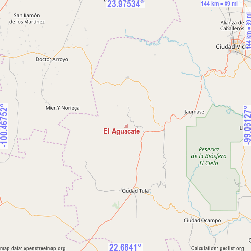
El Aguacate GPS coordinates[2]
23° 19' 52.644" North, 99° 45' 51.804" West
| Map corner | latitude | longitude |
|---|---|---|
| Upper-left | 23.97534°, | -100.46752° |
| Center: | 23.33129°, | -99.76439° |
| Lower-right: | 22.6841°, | -99.06127° |
| Map W x H: | 143.6×143.6 km | = 89.2×89.2mi |
| max Lat: | 32.7° ⇑11.3% North |
| El Aguacate: | 23.33129° |
| min Lat: | ⇓88.7% South 14.53588° |
| min Long | El Aguacate | max Long |
| -117.105° | -99.76439° | -86.73105° |
| W 39%⇐ | ⇒61% E |
Elevation
Elevation of El Aguacate is 1360 m = 4462 ft, and this is 106.3 m = 349 ft above average elevation for this country.
| Max E: |
3497 m = 11473 ft | 51.5% |
| El Aguacate | 1360 m 4462 ft | |
| Avg. | 1253.7 m = 4113 ft | |
Min E: |
-1 m = -3 ft | 48.5% |
See also: Mexico elevation on elevation.city.
Geographical zone
El Aguacate is located in North Torrid zone (between Equator and Tropic of Cancer). Distance of this Northern Tropic circle is 11.7 km =7.3 mi to North.| Distance of | km | miles | from El Aguacate |
|---|---|---|---|
| North Pole | 7412.9 | 4606.2 | to North |
| Arctic Circle | 4807 | 2986.9 | to North |
| Tropic Cancer | 11.7 | 7.3 | to North |
| Equator | 2594.2 | 1612 | to South |


Nearby cities:
15 places around El Aguacate: (largest is in red/bold)
• Bustamante
11.6 km =7.2 mi,  2°
2°
• Calabacillas
12.9 km =8 mi,  166°
166°
• Ciudad Tula
37.5 km =23.3 mi, 171°
• Felipe Ángeles
6.5 km =4 mi,  8°
8°
• La Cardona
23.5 km =14.6 mi,  289°
289°
• La Peña
26.4 km =16.4 mi,  17°
17°
• Mier y Noriega
37.4 km =23.2 mi, 285°
• Miquihuana
27.2 km =16.9 mi, 2°
• Palmillas
22.2 km =13.8 mi,  98°
98°
• Salitrillo
19.7 km =12.2 mi,  199°
199°
• San José del Llano
28.6 km =17.8 mi,  322°
322°
• San Juanito
38.3 km =23.8 mi,  68°
68°
• San Rafael
23.2 km =14.4 mi,  187°
187°
• Santa Ana de Nahola
39.2 km =24.4 mi, 196°
• Álvaro Obregón
18.9 km =11.7 mi,  157°
157°
Sources, notices
• [Note1] Compared only with cities in Mexico existing in our database
• [Src1] Map data: © OpenStreetMap contributors (CC-BY-SA)
• [Src2] Other city data from geonames.org with taken over terms of usage.
• [Src3] Geographical zone / Annual Mean Temperature by Robert A. Rohde @ Wikipedia
