Lázaro Cárdenas geodata
Lázaro Cárdenas (Tamaulipas) is a populated place; located in Mexico in America/Mexico_City (GMT-6) time zone. With population of 1,075 people, there are 8116 cities with bigger population in this country. Compared to other cities in Mexico, 87.9% of cities are located further ↓South; 64.6% of cities are located further →East and 57.8% of cities have higher elevation than Lázaro Cárdenas. Note1


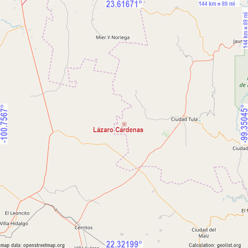
Lázaro Cárdenas GPS coordinates[2]
22° 58' 15.24" North, 100° 3' 12.852" West
| Map corner | latitude | longitude |
|---|---|---|
| Upper-left | 23.61671°, | -100.7567° |
| Center: | 22.9709°, | -100.05357° |
| Lower-right: | 22.32199°, | -99.35045° |
| Map W x H: | 144×144 km | = 89.5×89.5mi |
| max Lat: | 32.7° ⇑12.1% North |
| Lázaro Cárdenas: | 22.9709° |
| min Lat: | ⇓87.9% South 14.53588° |
| min Long | Lázaro Cárden | max Long |
| -117.105° | -100.05357° | -86.73105° |
| W 35.4%⇐ | ⇒64.6% E |
Elevation
Elevation of Lázaro Cárdenas is 1108 m = 3635 ft, and this is 145.7 m = 478 ft below average elevation for this country.
| Max E: |
3497 m = 11473 ft | 57.8% |
| Avg. | 1253.7 m = 4113 ft | |
| Lázaro Cárdenas | 1108 m = 3635 ft | |
Min E: |
-1 m = -3 ft | 42.2% |
See also: Mexico elevation on elevation.city.
Geographical zone
Lázaro Cárdenas is located in North Torrid zone (between Equator and Tropic of Cancer). Distance of this Northern Tropic circle is 51.8 km =32.2 mi to North.| Distance of | km | miles | from Lázaro Cárdenas |
|---|---|---|---|
| North Pole | 7452.9 | 4631 | to North |
| Arctic Circle | 4847 | 3011.8 | to North |
| Tropic Cancer | 51.8 | 32.2 | to North |
| Equator | 2554.1 | 1587 | to South |


Nearby cities:
15 places around Lázaro Cárdenas: (largest is in red/bold)
• Ciudad Tula
35.2 km =21.9 mi,  85°
85°
• El Custodio
36.5 km =22.7 mi,  166°
166°
• El Huisache
35.7 km =22.2 mi,  260°
260°
• Emiliano Zapata
24.6 km =15.3 mi,  162°
162°
• La Hincada
35.1 km =21.8 mi,  188°
188°
• La Pólvora
29.5 km =18.3 mi, 261°
• La Ventana
22 km =13.7 mi,  281°
281°
• Magdaleno Cedillo
23.5 km =14.6 mi,  149°
149°
• Negritas
22.5 km =14 mi,  208°
208°
• Salitrillo
31.5 km =19.6 mi,  47°
47°
• San Ignacio
27.6 km =17.1 mi,  332°
332°
• San Rafael
31.6 km =19.6 mi,  57°
57°
• Santa Ana de Nahola
18.9 km =11.7 mi,  82°
82°
• Santo Domingo
26.3 km =16.3 mi,  243°
243°
• Tanque Blanco
29.4 km =18.3 mi, 93°
Sources, notices
• [Note1] Compared only with cities in Mexico existing in our database
• [Src1] Map data: © OpenStreetMap contributors (CC-BY-SA)
• [Src2] Other city data from geonames.org with taken over terms of usage.
• [Src3] Geographical zone / Annual Mean Temperature by Robert A. Rohde @ Wikipedia
