Carvajal geodata
Carvajal (Tamaulipas) is a populated place; located in Mexico in America/Monterrey (GMT-6) time zone. With population of 891 people, there are 9789 cities with bigger population in this country. Compared to other cities in Mexico, 90.9% of cities are located further ↓South; 66.8% of cities are located further ←West and 99.1% of cities have higher elevation than Carvajal. Note1


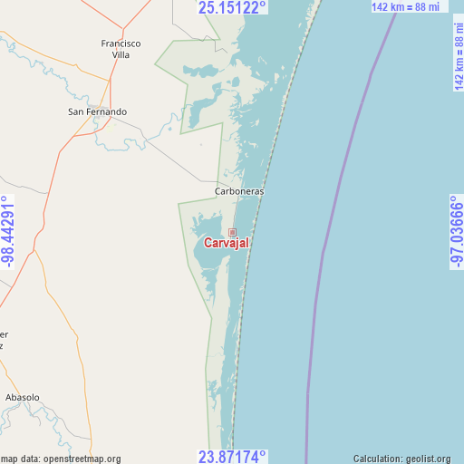
Carvajal GPS coordinates[2]
24° 30' 47.196" North, 97° 44' 23.208" West
| Map corner | latitude | longitude |
|---|---|---|
| Upper-left | 25.15122°, | -98.44291° |
| Center: | 24.51311°, | -97.73978° |
| Lower-right: | 23.87174°, | -97.03666° |
| Map W x H: | 142.3×142.3 km | = 88.4×88.4mi |
| max Lat: | 32.7° ⇑9.1% North |
| Carvajal: | 24.51311° |
| min Lat: | ⇓90.9% South 14.53588° |
| min Long | Carvajal | max Long |
| -117.105° | -97.73978° | -86.73105° |
| W 66.8%⇐ | ⇒33.2% E |
Elevation
Elevation of Carvajal is 6 m = 20 ft, and this is 1247.7 m = 4094 ft below average elevation for this country.
| Max E: |
3497 m = 11473 ft | 99.1% |
| Avg. | 1253.7 m = 4113 ft | |
| Carvajal | 6 m = 20 ft | |
Min E: |
-1 m = -3 ft | 0.9% |
See also: Mexico elevation on elevation.city.
Geographical zone
Carvajal is located in North temperate zone (between Tropic of Cancer and the Arctic Circle). Distance of this Northern Tropic circle is 119.7 km =74.4 mi to South.| Distance of | km | miles | from Carvajal |
|---|---|---|---|
| North Pole | 7281.5 | 4524.5 | to North |
| Arctic Circle | 4675.6 | 2905.3 | to North |
| Tropic Cancer | 119.7 | 74.4 | to South |
| Equator | 2725.6 | 1693.6 | to South |


Nearby cities:
15 places around Carvajal: (largest is in red/bold)
• Alfredo V. Bonfil
79.7 km =49.5 mi,  344°
344°
• Allende
79 km =49.1 mi,  239°
239°
• Carboneras
12.9 km =8 mi,  10°
10°
• División del Norte
44.1 km =27.4 mi,  316°
316°
• El Barrancón del Tío Blas (El Barrancón)
55.9 km =34.7 mi,  2°
2°
• Emiliano Zapata (Ampliación San Germán)
71.5 km =44.4 mi,  333°
333°
• Guadalupe Victoria
69.3 km =43.1 mi,  226°
226°
• La Lomita
70.8 km =44 mi, 332°
• La Pesca
80.9 km =50.3 mi,  182°
182°
• Miguel de la Madrid
81.1 km =50.4 mi, 181°
• Nicolás Bravo
77.5 km =48.2 mi,  222°
222°
• Punta de Alambre
4.2 km =2.6 mi, 8°
• Punta de Piedra
2.1 km =1.3 mi,  190°
190°
• San Fernando
55.5 km =34.5 mi,  312°
312°
• San Germán
80.4 km =50 mi,  346°
346°
Sources, notices
• [Note1] Compared only with cities in Mexico existing in our database
• [Src1] Map data: © OpenStreetMap contributors (CC-BY-SA)
• [Src2] Other city data from geonames.org with taken over terms of usage.
• [Src3] Geographical zone / Annual Mean Temperature by Robert A. Rohde @ Wikipedia
