Zumpahuacán geodata
Zumpahuacán (State of Mexico) is a populated place; located in Mexico in America/Mexico_City (GMT-6) time zone. With population of 4,450 people, there are 2066 cities with bigger population in this country. Compared to other cities in Mexico, 66.6% of cities are located further ↑North; 57.9% of cities are located further →East and 89.1% of cities have lower elevation than Zumpahuacán. Note1


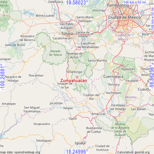
Zumpahuacán GPS coordinates[2]
18° 54' 59.112" North, 99° 33' 56.448" West
| Map corner | latitude | longitude |
|---|---|---|
| Upper-left | 19.58023°, | -100.26881° |
| Center: | 18.91642°, | -99.56568° |
| Lower-right: | 18.24996°, | -98.86256° |
| Map W x H: | 147.9×147.9 km | = 91.9×91.9mi |
| max Lat: | 32.7° ⇑66.6% North |
| Zumpahuacán: | 18.91642° |
| min Lat: | ⇓33.4% South 14.53588° |
| min Long | Zumpahuacán | max Long |
| -117.105° | -99.56568° | -86.73105° |
| W 42.1%⇐ | ⇒57.9% E |
Elevation
Elevation of Zumpahuacán is 2376 m = 7795 ft, and this is 1122.3 m = 3682 ft above average elevation for this country.
| Max E: |
3497 m = 11473 ft | 10.9% |
| Zumpahuacán | 2376 m 7795 ft | |
| Avg. | 1253.7 m = 4113 ft | |
Min E: |
-1 m = -3 ft | 89.1% |
See also: Mexico elevation on elevation.city.
Geographical zone
Zumpahuacán is located in North Torrid zone (between Equator and Tropic of Cancer). Distance of this Northern Tropic circle is 502.6 km =312.3 mi to North.| Distance of | km | miles | from Zumpahuacán |
|---|---|---|---|
| North Pole | 7903.8 | 4911.2 | to North |
| Arctic Circle | 5297.9 | 3292 | to North |
| Tropic Cancer | 502.6 | 312.3 | to North |
| Equator | 2103.3 | 1306.9 | to South |


Nearby cities:
15 places around Zumpahuacán: (largest is in red/bold)
• Acatzingo (Acatzingo de la Piedra)
2.6 km =1.6 mi,  289°
289°
• Colonia Emiliano Zapata Ejido de Tenancingo
4.2 km =2.6 mi,  9°
9°
• Ejido Ixpuchiapan
3.5 km =2.2 mi,  346°
346°
• Ejido de Tenería (El Llano)
4.5 km =2.8 mi,  359°
359°
• El Carmen (El Desierto del Carmen)
1 km =0.6 mi,  65°
65°
• Ixpuichiapan
2.9 km =1.8 mi,  309°
309°
• Palmar de Guadalupe
3.5 km =2.2 mi,  111°
111°
• Pueblo Nuevo
4 km =2.5 mi,  331°
331°
• Quetzalapa
4.2 km =2.6 mi, 309°
• San Antonio Guadalupe
4.3 km =2.7 mi,  251°
251°
• San José Tenería (Tenería)
4.5 km =2.8 mi,  32°
32°
• San Nicolás
1.9 km =1.2 mi, 351°
• Santa Catarina
4.1 km =2.5 mi,  207°
207°
• Tepalcatepec
4.1 km =2.5 mi,  301°
301°
• Terrenate
3.2 km =2 mi, 292°
Sources, notices
• [Note1] Compared only with cities in Mexico existing in our database
• [Src1] Map data: © OpenStreetMap contributors (CC-BY-SA)
• [Src2] Other city data from geonames.org with taken over terms of usage.
• [Src3] Geographical zone / Annual Mean Temperature by Robert A. Rohde @ Wikipedia
