San Antonio Guadalupe geodata
San Antonio Guadalupe (State of Mexico) is a populated place; located in Mexico in America/Mexico_City (GMT-6) time zone. With population of 849 people, there are 10304 cities with bigger population in this country. Compared to other cities in Mexico, 66.9% of cities are located further ↑North; 58.6% of cities are located further →East and 67.2% of cities have lower elevation than San Antonio Guadalupe. Note1
Current local time in San Antonio Guadalupe:
03:42 AM, WednesdayDifference from your time zone: hours


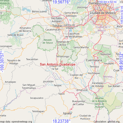
San Antonio Guadalupe GPS coordinates[2]
18° 54' 14.004" North, 99° 36' 15.984" West
| Map corner | latitude | longitude |
|---|---|---|
| Upper-left | 19.56776°, | -100.30757° |
| Center: | 18.90389°, | -99.60444° |
| Lower-right: | 18.23738°, | -98.90132° |
| Map W x H: | 147.9×147.9 km | = 91.9×91.9mi |
| max Lat: | 32.7° ⇑66.9% North |
| San Antonio Guadalupe: | 18.90389° |
| min Lat: | ⇓33.1% South 14.53588° |
| min Long | San Antonio Gua | max Long |
| -117.105° | -99.60444° | -86.73105° |
| W 41.4%⇐ | ⇒58.6% E |
Elevation
Elevation of San Antonio Guadalupe is 1874 m = 6148 ft, and this is 620.3 m = 2035 ft above average elevation for this country.
| Max E: |
3497 m = 11473 ft | 32.8% |
| San Antonio Guadalupe | 1874 m 6148 ft | |
| Avg. | 1253.7 m = 4113 ft | |
Min E: |
-1 m = -3 ft | 67.2% |
See also: Mexico elevation on elevation.city.
Geographical zone
San Antonio Guadalupe is located in North Torrid zone (between Equator and Tropic of Cancer). Distance of this Northern Tropic circle is 504 km =313.2 mi to North.| Distance of | km | miles | from San Antonio Guadalupe |
|---|---|---|---|
| North Pole | 7905.1 | 4912 | to North |
| Arctic Circle | 5299.3 | 3292.8 | to North |
| Tropic Cancer | 504 | 313.2 | to North |
| Equator | 2101.9 | 1306.1 | to South |


Nearby cities:
15 places around San Antonio Guadalupe: (largest is in red/bold)
• Acatzingo (Acatzingo de la Piedra)
2.8 km =1.7 mi,  36°
36°
• Ejido de la Finca
3.1 km =1.9 mi,  230°
230°
• Guadalupe Tlapizalco
2.8 km =1.7 mi,  194°
194°
• Ixpuichiapan
3.7 km =2.3 mi,  29°
29°
• La Finca
4.1 km =2.5 mi,  248°
248°
• La Lagunilla
2.9 km =1.8 mi,  332°
332°
• Potrero Nuevo
2.6 km =1.6 mi,  258°
258°
• Quetzalapa
4.2 km =2.6 mi,  10°
10°
• San Nicolás
5 km =3.1 mi,  49°
49°
• San Pablo Tejalpa
4.4 km =2.7 mi,  161°
161°
• Santa Catarina
3.1 km =1.9 mi,  136°
136°
• Tepalcatepec
3.6 km =2.2 mi, 8°
• Tepetzingo
3.9 km =2.4 mi,  347°
347°
• Terrenate
2.9 km =1.8 mi,  23°
23°
• Zumpahuacán
4.3 km =2.7 mi,  71°
71°
Sources, notices
• [Note1] Compared only with cities in Mexico existing in our database
• [Src1] Map data: © OpenStreetMap contributors (CC-BY-SA)
• [Src2] Other city data from geonames.org with taken over terms of usage.
• [Src3] Geographical zone / Annual Mean Temperature by Robert A. Rohde @ Wikipedia
