Zapotlán de Juárez geodata
Zapotlán de Juárez (Hidalgo) is a seat of a second-order administrative division; located in Mexico in America/Mexico_City (GMT-6) time zone. With population of 4,961 people, there are 1864 cities with bigger population in this country. Compared to other cities in Mexico, 56.5% of cities are located further ↓South; 52.5% of cities are located further ←West and 89.2% of cities have lower elevation than Zapotlán de Juárez. Note1


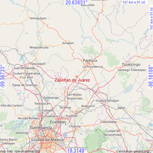
Zapotlán de Juárez GPS coordinates[2]
19° 58' 37.524" North, 98° 51' 51.12" West
| Map corner | latitude | longitude |
|---|---|---|
| Upper-left | 20.63651°, | -99.56733° |
| Center: | 19.97709°, | -98.8642° |
| Lower-right: | 19.3149°, | -98.16108° |
| Map W x H: | 146.9×147 km | = 91.3×91.3mi |
| max Lat: | 32.7° ⇑43.5% North |
| Zapotlán de Juárez: | 19.97709° |
| min Lat: | ⇓56.5% South 14.53588° |
| min Long | Zapotlán de Ju | max Long |
| -117.105° | -98.8642° | -86.73105° |
| W 52.5%⇐ | ⇒47.5% E |
Elevation
Elevation of Zapotlán de Juárez is 2380 m = 7808 ft, and this is 1126.3 m = 3695 ft above average elevation for this country.
| Max E: |
3497 m = 11473 ft | 10.8% |
| Zapotlán de Juárez | 2380 m 7808 ft | |
| Avg. | 1253.7 m = 4113 ft | |
Min E: |
-1 m = -3 ft | 89.2% |
See also: Mexico elevation on elevation.city.
Geographical zone
Zapotlán de Juárez is located in North Torrid zone (between Equator and Tropic of Cancer). Distance of this Northern Tropic circle is 384.7 km =239 mi to North.| Distance of | km | miles | from Zapotlán de Juárez |
|---|---|---|---|
| North Pole | 7785.8 | 4837.9 | to North |
| Arctic Circle | 5179.9 | 3218.6 | to North |
| Tropic Cancer | 384.7 | 239 | to North |
| Equator | 2221.2 | 1380.2 | to South |


Nearby cities:
15 places around Zapotlán de Juárez: (largest is in red/bold)
• Acayuca
5.9 km =3.7 mi,  24°
24°
• Colonia Guadalupe
11.1 km =6.9 mi,  112°
112°
• Colonia Morelos
10.8 km =6.7 mi,  152°
152°
• Colonia Nueva Tlaxiaca
5.8 km =3.6 mi,  11°
11°
• El Mirador
8.1 km =5 mi,  43°
43°
• General Felipe Ángeles (Los Ángeles)
11 km =6.8 mi,  216°
216°
• Ixtlahuaca de Cuauhtémoc
10.6 km =6.6 mi,  177°
177°
• Jagüey de Téllez (Estación Téllez)
7.9 km =4.9 mi,  87°
87°
• Las Pintas
9.3 km =5.8 mi,  194°
194°
• Lindavista
8.8 km =5.5 mi,  51°
51°
• San Pedro Huaquilpan
1.3 km =0.8 mi,  343°
343°
• Santiago Tlajomulco
5.5 km =3.4 mi,  281°
281°
• Tolcayuca
6.1 km =3.8 mi,  249°
249°
• Vicente Guerrero (San Javier)
4.9 km =3 mi,  232°
232°
• Villas de San Marcos
9.9 km =6.2 mi, 54°
Sources, notices
• [Note1] Compared only with cities in Mexico existing in our database
• [Src1] Map data: © OpenStreetMap contributors (CC-BY-SA)
• [Src2] Other city data from geonames.org with taken over terms of usage.
• [Src3] Geographical zone / Annual Mean Temperature by Robert A. Rohde @ Wikipedia
