Colonia Guadalupe geodata
Colonia Guadalupe (Hidalgo) is a populated place; located in Mexico in America/Mexico_City (GMT-6) time zone. With population of 1,233 people, there are 7040 cities with bigger population in this country. Compared to other cities in Mexico, 55.8% of cities are located further ↓South; 54.1% of cities are located further ←West and 91.9% of cities have lower elevation than Colonia Guadalupe. Note1


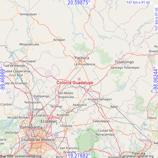
Colonia Guadalupe GPS coordinates[2]
19° 56' 21.012" North, 98° 45' 56.016" West
| Map corner | latitude | longitude |
|---|---|---|
| Upper-left | 20.59875°, | -99.46869° |
| Center: | 19.93917°, | -98.76556° |
| Lower-right: | 19.27682°, | -98.06244° |
| Map W x H: | 147×147 km | = 91.3×91.3mi |
| max Lat: | 32.7° ⇑44.2% North |
| Colonia Guadalupe: | 19.93917° |
| min Lat: | ⇓55.8% South 14.53588° |
| min Long | Colonia Guadalu | max Long |
| -117.105° | -98.76556° | -86.73105° |
| W 54.1%⇐ | ⇒45.9% E |
Elevation
Elevation of Colonia Guadalupe is 2477 m = 8127 ft, and this is 1223.3 m = 4013 ft above average elevation for this country.
| Max E: |
3497 m = 11473 ft | 8.1% |
| Colonia Guadalupe | 2477 m 8127 ft | |
| Avg. | 1253.7 m = 4113 ft | |
Min E: |
-1 m = -3 ft | 91.9% |
See also: Mexico elevation on elevation.city.
Geographical zone
Colonia Guadalupe is located in North Torrid zone (between Equator and Tropic of Cancer). Distance of this Northern Tropic circle is 388.9 km =241.7 mi to North.| Distance of | km | miles | from Colonia Guadalupe |
|---|---|---|---|
| North Pole | 7790 | 4840.5 | to North |
| Arctic Circle | 5184.1 | 3221.2 | to North |
| Tropic Cancer | 388.9 | 241.7 | to North |
| Equator | 2217 | 1377.6 | to South |


Nearby cities:
15 places around Colonia Guadalupe: (largest is in red/bold)
• Colonia Benito Juárez
7 km =4.3 mi,  218°
218°
• Colonia Morelos
7.6 km =4.7 mi, 224°
• Guadalupe Relinas
7.2 km =4.5 mi,  189°
189°
• Jagüey de Téllez (Estación Téllez)
5.2 km =3.2 mi,  332°
332°
• La Trinidad
6.3 km =3.9 mi,  68°
68°
• Lindavista
10.2 km =6.3 mi,  340°
340°
• San Agustín Zapotlán
8.9 km =5.5 mi,  142°
142°
• San José Palma Gorda
9.4 km =5.8 mi,  9°
9°
• San Miguel Nopalapa
10.1 km =6.3 mi,  33°
33°
• San Pedro Tlaquilpan
1.5 km =0.9 mi,  63°
63°
• Santa Cruz
8.8 km =5.5 mi,  76°
76°
• Santa María Actipac
9.5 km =5.9 mi,  167°
167°
• Tezontepec
8.6 km =5.3 mi, 221°
• Villa Margarita
6.9 km =4.3 mi,  47°
47°
• Xochihuacán
7.9 km =4.9 mi, 47°
Sources, notices
• [Note1] Compared only with cities in Mexico existing in our database
• [Src1] Map data: © OpenStreetMap contributors (CC-BY-SA)
• [Src2] Other city data from geonames.org with taken over terms of usage.
• [Src3] Geographical zone / Annual Mean Temperature by Robert A. Rohde @ Wikipedia
