Zacatepec geodata
Zacatepec (Puebla) is a populated place; located in Mexico in America/Mexico_City (GMT-6) time zone. With population of 10,204 people, there are 930 cities with bigger population in this country. Compared to other cities in Mexico, 59.5% of cities are located further ↑North; 69.2% of cities are located further ←West and 88.9% of cities have lower elevation than Zacatepec. Note1


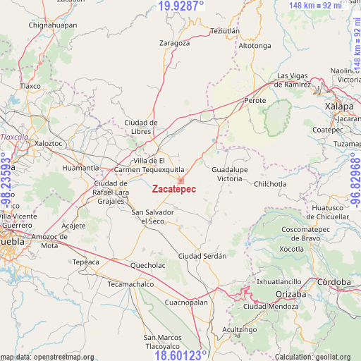
Zacatepec GPS coordinates[2]
19° 15' 58.716" North, 97° 31' 58.08" West
| Map corner | latitude | longitude |
|---|---|---|
| Upper-left | 19.9287°, | -98.23593° |
| Center: | 19.26631°, | -97.5328° |
| Lower-right: | 18.60123°, | -96.82968° |
| Map W x H: | 147.6×147.6 km | = 91.7×91.7mi |
| max Lat: | 32.7° ⇑59.5% North |
| Zacatepec: | 19.26631° |
| min Lat: | ⇓40.5% South 14.53588° |
| min Long | Zacatepec | max Long |
| -117.105° | -97.5328° | -86.73105° |
| W 69.2%⇐ | ⇒30.8% E |
Elevation
Elevation of Zacatepec is 2368 m = 7769 ft, and this is 1114.3 m = 3656 ft above average elevation for this country.
| Max E: |
3497 m = 11473 ft | 11.1% |
| Zacatepec | 2368 m 7769 ft | |
| Avg. | 1253.7 m = 4113 ft | |
Min E: |
-1 m = -3 ft | 88.9% |
See also: Mexico elevation on elevation.city.
Geographical zone
Zacatepec is located in North Torrid zone (between Equator and Tropic of Cancer). Distance of this Northern Tropic circle is 463.7 km =288.1 mi to North.| Distance of | km | miles | from Zacatepec |
|---|---|---|---|
| North Pole | 7864.8 | 4887 | to North |
| Arctic Circle | 5259 | 3267.8 | to North |
| Tropic Cancer | 463.7 | 288.1 | to North |
| Equator | 2142.2 | 1331.1 | to South |


Nearby cities:
15 places around Zacatepec: (largest is in red/bold)
• Emilio Portes Gil
5.2 km =3.2 mi,  27°
27°
• Hacienda Nueva (San Pedro el Águila)
14.7 km =9.1 mi,  59°
59°
• José María Morelos
15.5 km =9.6 mi,  153°
153°
• Miguel Hidalgo
6.9 km =4.3 mi,  167°
167°
• Miravalles
8.4 km =5.2 mi,  355°
355°
• Nuevo Centro de Población Tlachichuca
4.2 km =2.6 mi,  295°
295°
• Nuevo Vicencio
16.2 km =10.1 mi,  278°
278°
• Oriental
15.3 km =9.5 mi,  322°
322°
• San José Barroso
12.7 km =7.9 mi,  227°
227°
• San Miguel Tecuitlapa
16.2 km =10.1 mi,  185°
185°
• San Nicolas Buenos Aires
11.4 km =7.1 mi, 189°
• Santa Cecilia Tepetitlán
13.2 km =8.2 mi,  128°
128°
• Venustiano Carranza
7.3 km =4.5 mi, 127°
• Villa de El Carmen Tequexquitla
14.2 km =8.8 mi, 296°
• Álamos Tepetitlán
12.6 km =7.8 mi, 128°
Sources, notices
• [Note1] Compared only with cities in Mexico existing in our database
• [Src1] Map data: © OpenStreetMap contributors (CC-BY-SA)
• [Src2] Other city data from geonames.org with taken over terms of usage.
• [Src3] Geographical zone / Annual Mean Temperature by Robert A. Rohde @ Wikipedia
