Nuevo Vicencio geodata
Nuevo Vicencio (Puebla) is a populated place; located in Mexico in America/Mexico_City (GMT-6) time zone. With population of 581 people, there are 14753 cities with bigger population in this country. Compared to other cities in Mexico, 59.1% of cities are located further ↑North; 67.5% of cities are located further ←West and 88.5% of cities have lower elevation than Nuevo Vicencio. Note1


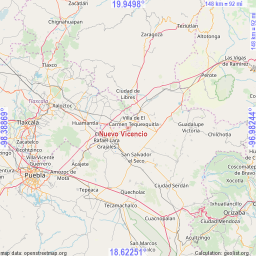
Nuevo Vicencio GPS coordinates[2]
19° 17' 15" North, 97° 41' 8.016" West
| Map corner | latitude | longitude |
|---|---|---|
| Upper-left | 19.9498°, | -98.38869° |
| Center: | 19.2875°, | -97.68556° |
| Lower-right: | 18.62251°, | -96.98244° |
| Map W x H: | 147.6×147.6 km | = 91.7×91.7mi |
| max Lat: | 32.7° ⇑59.1% North |
| Nuevo Vicencio: | 19.2875° |
| min Lat: | ⇓40.9% South 14.53588° |
| min Long | Nuevo Vicencio | max Long |
| -117.105° | -97.68556° | -86.73105° |
| W 67.5%⇐ | ⇒32.5% E |
Elevation
Elevation of Nuevo Vicencio is 2358 m = 7736 ft, and this is 1104.3 m = 3623 ft above average elevation for this country.
| Max E: |
3497 m = 11473 ft | 11.5% |
| Nuevo Vicencio | 2358 m 7736 ft | |
| Avg. | 1253.7 m = 4113 ft | |
Min E: |
-1 m = -3 ft | 88.5% |
See also: Mexico elevation on elevation.city.
Geographical zone
Nuevo Vicencio is located in North Torrid zone (between Equator and Tropic of Cancer). Distance of this Northern Tropic circle is 461.4 km =286.7 mi to North.| Distance of | km | miles | from Nuevo Vicencio |
|---|---|---|---|
| North Pole | 7862.5 | 4885.5 | to North |
| Arctic Circle | 5256.6 | 3266.3 | to North |
| Tropic Cancer | 461.4 | 286.7 | to North |
| Equator | 2144.6 | 1332.6 | to South |


Nearby cities:
15 places around Nuevo Vicencio: (largest is in red/bold)
• Colonia Ignacio Allende
12.9 km =8 mi,  306°
306°
• Colonia José María Morelos
8.4 km =5.2 mi,  350°
350°
• Cuapiaxtla
8.8 km =5.5 mi,  276°
276°
• La Soledad
7.9 km =4.9 mi,  356°
356°
• Nuevo Centro de Población Tlachichuca
12.2 km =7.6 mi,  92°
92°
• Oriental
12 km =7.5 mi,  34°
34°
• Plan de Ayala
6.1 km =3.8 mi,  293°
293°
• San Francisco Cuexcontzi
4.5 km =2.8 mi,  323°
323°
• San José Barroso
12.8 km =8 mi,  148°
148°
• San José Chiapa
9.9 km =6.2 mi,  238°
238°
• San José Ozumba
7.5 km =4.7 mi,  216°
216°
• Santa Cruz Magdalena
10 km =6.2 mi,  22°
22°
• Santa Cruz Pocitos
12.9 km =8 mi, 322°
• Santa María las Cuevas
12.3 km =7.6 mi,  332°
332°
• Villa de El Carmen Tequexquitla
5.3 km =3.3 mi,  39°
39°
Sources, notices
• [Note1] Compared only with cities in Mexico existing in our database
• [Src1] Map data: © OpenStreetMap contributors (CC-BY-SA)
• [Src2] Other city data from geonames.org with taken over terms of usage.
• [Src3] Geographical zone / Annual Mean Temperature by Robert A. Rohde @ Wikipedia
