Zacapala geodata
Zacapala (Puebla) is a seat of a second-order administrative division; located in Mexico in America/Mexico_City (GMT-6) time zone. With population of 1,071 people, there are 8151 cities with bigger population in this country. Compared to other cities in Mexico, 71.5% of cities are located further ↑North; 62.8% of cities are located further ←West and 52.2% of cities have higher elevation than Zacapala. Note1


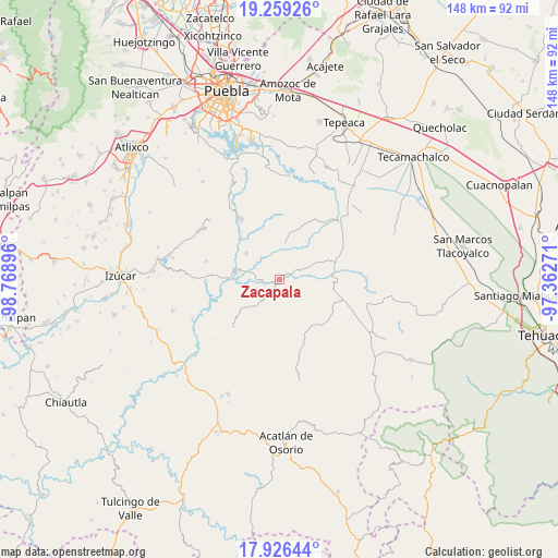
Zacapala GPS coordinates[2]
18° 35' 38.94" North, 98° 3' 56.988" West
| Map corner | latitude | longitude |
|---|---|---|
| Upper-left | 19.25926°, | -98.76896° |
| Center: | 18.59415°, | -98.06583° |
| Lower-right: | 17.92644°, | -97.36271° |
| Map W x H: | 148.2×148.2 km | = 92.1×92.1mi |
| max Lat: | 32.7° ⇑71.5% North |
| Zacapala: | 18.59415° |
| min Lat: | ⇓28.5% South 14.53588° |
| min Long | Zacapala | max Long |
| -117.105° | -98.06583° | -86.73105° |
| W 62.8%⇐ | ⇒37.2% E |
Elevation
Elevation of Zacapala is 1326 m = 4350 ft, and this is 72.3 m = 237 ft above average elevation for this country.
| Max E: |
3497 m = 11473 ft | 52.2% |
| Zacapala | 1326 m 4350 ft | |
| Avg. | 1253.7 m = 4113 ft | |
Min E: |
-1 m = -3 ft | 47.8% |
See also: Mexico elevation on elevation.city.
Geographical zone
Zacapala is located in North Torrid zone (between Equator and Tropic of Cancer). Distance of this Northern Tropic circle is 538.4 km =334.5 mi to North.| Distance of | km | miles | from Zacapala |
|---|---|---|---|
| North Pole | 7939.6 | 4933.4 | to North |
| Arctic Circle | 5333.7 | 3314.2 | to North |
| Tropic Cancer | 538.4 | 334.5 | to North |
| Equator | 2067.5 | 1284.7 | to South |


Nearby cities:
15 places around Zacapala: (largest is in red/bold)
• Agua Santa Ana
14.5 km =9 mi,  126°
126°
• Almolonga
17 km =10.6 mi,  140°
140°
• Chapultepec (Santo Domingo)
14.3 km =8.9 mi,  146°
146°
• Chigmecatitlán
5.8 km =3.6 mi,  353°
353°
• Coatzingo
11.4 km =7.1 mi,  279°
279°
• Colonia Morelos (Pie de Vaca)
15.8 km =9.8 mi,  89°
89°
• El Rosario Xochitiopan
12.5 km =7.8 mi,  67°
67°
• Huajoyuca
16.3 km =10.1 mi,  123°
123°
• Huatlatlauca
9.8 km =6.1 mi,  9°
9°
• Moralillo
13.8 km =8.6 mi,  111°
111°
• San Pablo Soyatitlanapan
11.1 km =6.9 mi,  307°
307°
• Santa Catarina Tlaltempan
2.8 km =1.7 mi,  326°
326°
• Tepetzitzintla
10.4 km =6.5 mi,  355°
355°
• Tepexi de Rodríguez
14.8 km =9.2 mi,  95°
95°
• Victoria
14.7 km =9.1 mi,  62°
62°
Sources, notices
• [Note1] Compared only with cities in Mexico existing in our database
• [Src1] Map data: © OpenStreetMap contributors (CC-BY-SA)
• [Src2] Other city data from geonames.org with taken over terms of usage.
• [Src3] Geographical zone / Annual Mean Temperature by Robert A. Rohde @ Wikipedia
