Coatzingo geodata
Coatzingo (Puebla) is a seat of a second-order administrative division; located in Mexico in America/Mexico_City (GMT-6) time zone. With population of 2,243 people, there are 3920 cities with bigger population in this country. Compared to other cities in Mexico, 71.3% of cities are located further ↑North; 61.6% of cities are located further ←West and 55.3% of cities have higher elevation than Coatzingo. Note1


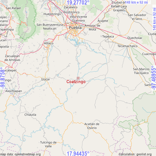
Coatzingo GPS coordinates[2]
18° 36' 43.164" North, 98° 10' 21.612" West
| Map corner | latitude | longitude |
|---|---|---|
| Upper-left | 19.27702°, | -98.8758° |
| Center: | 18.61199°, | -98.17267° |
| Lower-right: | 17.94435°, | -97.46955° |
| Map W x H: | 148.2×148.2 km | = 92.1×92.1mi |
| max Lat: | 32.7° ⇑71.3% North |
| Coatzingo: | 18.61199° |
| min Lat: | ⇓28.7% South 14.53588° |
| min Long | Coatzingo | max Long |
| -117.105° | -98.17267° | -86.73105° |
| W 61.6%⇐ | ⇒38.4% E |
Elevation
Elevation of Coatzingo is 1186 m = 3891 ft, and this is 67.7 m = 222 ft below average elevation for this country.
| Max E: |
3497 m = 11473 ft | 55.3% |
| Avg. | 1253.7 m = 4113 ft | |
| Coatzingo | 1186 m = 3891 ft | |
Min E: |
-1 m = -3 ft | 44.7% |
See also: Mexico elevation on elevation.city.
Geographical zone
Coatzingo is located in North Torrid zone (between Equator and Tropic of Cancer). Distance of this Northern Tropic circle is 536.5 km =333.4 mi to North.| Distance of | km | miles | from Coatzingo |
|---|---|---|---|
| North Pole | 7937.6 | 4932.2 | to North |
| Arctic Circle | 5331.7 | 3313 | to North |
| Tropic Cancer | 536.5 | 333.4 | to North |
| Equator | 2069.5 | 1285.9 | to South |


Nearby cities:
15 places around Coatzingo: (largest is in red/bold)
• Ahuatlán
9.9 km =6.2 mi,  243°
243°
• Analco
13.6 km =8.5 mi,  358°
358°
• Chigmecatitlán
11.3 km =7 mi,  70°
70°
• Huatlatlauca
15 km =9.3 mi,  59°
59°
• Patlanoaya
17.3 km =10.7 mi,  223°
223°
• San Pablo Soyatitlanapan
5.4 km =3.4 mi,  27°
27°
• San Pedro Cuayuca
14.5 km =9 mi,  184°
184°
• Santa Catarina Tlaltempan
9.7 km =6 mi,  87°
87°
• Santo Domingo Huehuetlán
14.2 km =8.8 mi,  3°
3°
• Tejaluca
8.6 km =5.3 mi,  288°
288°
• Teopantlán
14.7 km =9.1 mi,  319°
319°
• Tepetzitzintla
13.4 km =8.3 mi,  51°
51°
• Totoltepec
18.9 km =11.7 mi,  283°
283°
• Xochiltepec
18.6 km =11.6 mi, 283°
• Zacapala
11.4 km =7.1 mi,  99°
99°
Sources, notices
• [Note1] Compared only with cities in Mexico existing in our database
• [Src1] Map data: © OpenStreetMap contributors (CC-BY-SA)
• [Src2] Other city data from geonames.org with taken over terms of usage.
• [Src3] Geographical zone / Annual Mean Temperature by Robert A. Rohde @ Wikipedia
