Almolonga geodata
Almolonga (Puebla) is a populated place; located in Mexico in America/Mexico_City (GMT-6) time zone. With population of 1,442 people, there are 5987 cities with bigger population in this country. Compared to other cities in Mexico, 72.9% of cities are located further ↑North; 64% of cities are located further ←West and 65.3% of cities have lower elevation than Almolonga. Note1


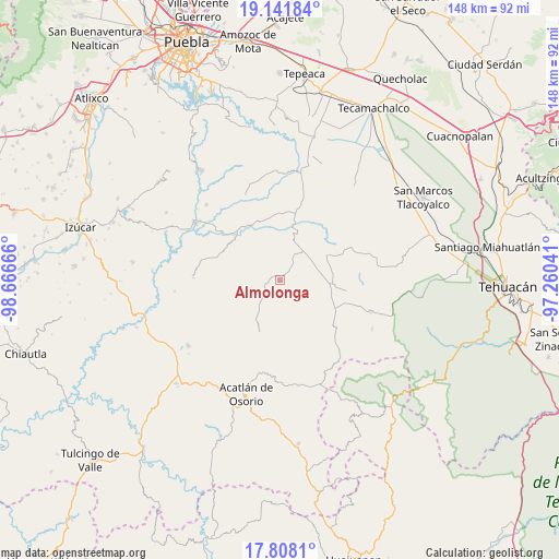
Almolonga GPS coordinates[2]
18° 28' 34.572" North, 97° 57' 48.708" West
| Map corner | latitude | longitude |
|---|---|---|
| Upper-left | 19.14184°, | -98.66666° |
| Center: | 18.47627°, | -97.96353° |
| Lower-right: | 17.8081°, | -97.26041° |
| Map W x H: | 148.3×148.3 km | = 92.1×92.1mi |
| max Lat: | 32.7° ⇑72.9% North |
| Almolonga: | 18.47627° |
| min Lat: | ⇓27.1% South 14.53588° |
| min Long | Almolonga | max Long |
| -117.105° | -97.96353° | -86.73105° |
| W 64%⇐ | ⇒36% E |
Elevation
Elevation of Almolonga is 1837 m = 6027 ft, and this is 583.3 m = 1914 ft above average elevation for this country.
| Max E: |
3497 m = 11473 ft | 34.7% |
| Almolonga | 1837 m 6027 ft | |
| Avg. | 1253.7 m = 4113 ft | |
Min E: |
-1 m = -3 ft | 65.3% |
See also: Mexico elevation on elevation.city.
Geographical zone
Almolonga is located in North Torrid zone (between Equator and Tropic of Cancer). Distance of this Northern Tropic circle is 551.6 km =342.7 mi to North.| Distance of | km | miles | from Almolonga |
|---|---|---|---|
| North Pole | 7952.7 | 4941.6 | to North |
| Arctic Circle | 5346.8 | 3322.3 | to North |
| Tropic Cancer | 551.6 | 342.7 | to North |
| Equator | 2054.4 | 1276.5 | to South |


Nearby cities:
15 places around Almolonga: (largest is in red/bold)
• Agua Santa Ana
4.5 km =2.8 mi,  10°
10°
• Ahuatempan
9.1 km =5.7 mi,  219°
219°
• Chapultepec (Santo Domingo)
3.1 km =1.9 mi,  292°
292°
• Colonia Morelos (Pie de Vaca)
14.2 km =8.8 mi,  20°
20°
• Guadalupe Victoria
14.2 km =8.8 mi,  61°
61°
• Huajoyuca
4.9 km =3 mi,  34°
34°
• Huejonapan
4.5 km =2.8 mi,  99°
99°
• La Concepción
12.5 km =7.8 mi, 216°
• Mariscala
6.7 km =4.2 mi,  45°
45°
• Moralillo
8.2 km =5.1 mi, 14°
• San Felipe Otlaltepec
10.2 km =6.3 mi,  144°
144°
• San Juan Ixcaquixtla
14.1 km =8.8 mi, 97°
• San Juan Nepomuceno
11 km =6.8 mi,  212°
212°
• Tepexi de Rodríguez
12.3 km =7.6 mi, 18°
• Tula
9 km =5.6 mi,  39°
39°
Sources, notices
• [Note1] Compared only with cities in Mexico existing in our database
• [Src1] Map data: © OpenStreetMap contributors (CC-BY-SA)
• [Src2] Other city data from geonames.org with taken over terms of usage.
• [Src3] Geographical zone / Annual Mean Temperature by Robert A. Rohde @ Wikipedia
