Yatzachi geodata
Yatzachi (Oaxaca) is a seat of a second-order administrative division; located in Mexico in America/Mexico_City (GMT-6) time zone. With population of 170 people, there are 16891 cities with bigger population in this country. Compared to other cities in Mexico, 86.2% of cities are located further ↑North; 81.3% of cities are located further ←West and 55.1% of cities have lower elevation than Yatzachi. Note1


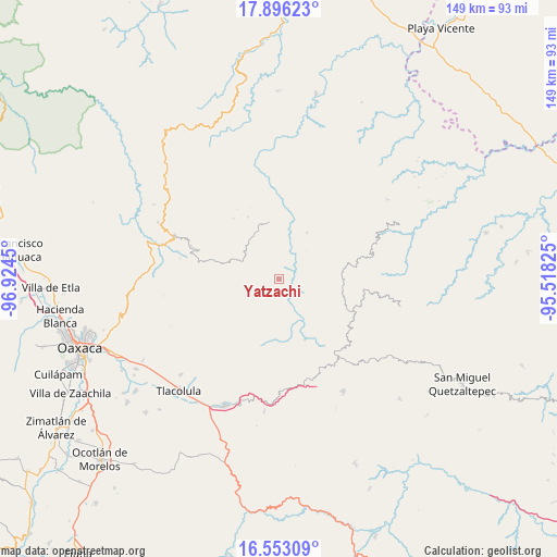
Yatzachi GPS coordinates[2]
17° 13' 33.168" North, 96° 13' 16.932" West
| Map corner | latitude | longitude |
|---|---|---|
| Upper-left | 17.89623°, | -96.9245° |
| Center: | 17.22588°, | -96.22137° |
| Lower-right: | 16.55309°, | -95.51825° |
| Map W x H: | 149.3×149.3 km | = 92.8×92.8mi |
| max Lat: | 32.7° ⇑86.2% North |
| Yatzachi: | 17.22588° |
| min Lat: | ⇓13.8% South 14.53588° |
| min Long | Yatzachi | max Long |
| -117.105° | -96.22137° | -86.73105° |
| W 81.3%⇐ | ⇒18.7% E |
Elevation
Elevation of Yatzachi is 1590 m = 5217 ft, and this is 336.3 m = 1103 ft above average elevation for this country.
| Max E: |
3497 m = 11473 ft | 44.9% |
| Yatzachi | 1590 m 5217 ft | |
| Avg. | 1253.7 m = 4113 ft | |
Min E: |
-1 m = -3 ft | 55.1% |
See also: Mexico elevation on elevation.city.
Geographical zone
Yatzachi is located in North Torrid zone (between Equator and Tropic of Cancer). Distance of this Northern Tropic circle is 690.6 km =429.1 mi to North.| Distance of | km | miles | from Yatzachi |
|---|---|---|---|
| North Pole | 8091.7 | 5027.9 | to North |
| Arctic Circle | 5485.8 | 3408.7 | to North |
| Tropic Cancer | 690.6 | 429.1 | to North |
| Equator | 1915.3 | 1190.1 | to South |


Nearby cities:
15 places around Yatzachi: (largest is in red/bold)
• Cajonos
7.7 km =4.8 mi,  213°
213°
• San Andrés Solaga
5.4 km =3.4 mi,  343°
343°
• San Andrés Yaá
10.3 km =6.4 mi,  43°
43°
• San Francisco Cajonos
6.8 km =4.2 mi, 206°
• San Juan Tabaá
8.9 km =5.5 mi,  9°
9°
• San Mateo Cajonos
7.3 km =4.5 mi,  168°
168°
• San Melchor Betaza
7.9 km =4.9 mi,  67°
67°
• Santiago Laxopa
9.6 km =6 mi,  265°
265°
• Santiago Zoochila
2.3 km =1.4 mi,  255°
255°
• Santo Domingo Yojovi
8.3 km =5.2 mi, 8°
• Villa Hidalgo
6.5 km =4 mi,  135°
135°
• Xagacía
9.3 km =5.8 mi, 211°
• Yaganiza
9 km =5.6 mi,  185°
185°
• Yalina
4.6 km =2.9 mi,  289°
289°
• Zoogocho
2.8 km =1.7 mi,  304°
304°
Sources, notices
• [Note1] Compared only with cities in Mexico existing in our database
• [Src1] Map data: © OpenStreetMap contributors (CC-BY-SA)
• [Src2] Other city data from geonames.org with taken over terms of usage.
• [Src3] Geographical zone / Annual Mean Temperature by Robert A. Rohde @ Wikipedia
