Ex- Hacienda de Ocotza geodata
Ex- Hacienda de Ocotza (Hidalgo) is a populated place; located in Mexico in America/Mexico_City (GMT-6) time zone. With population of 506 people, there are 16626 cities with bigger population in this country. Compared to other cities in Mexico, 66.2% of cities are located further ↓South; 51.1% of cities are located further →East and 69.6% of cities have lower elevation than Ex- Hacienda de Ocotza. Note1


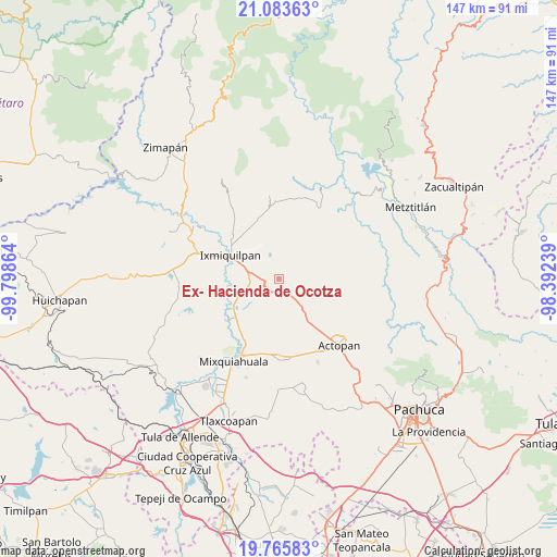
Ex- Hacienda de Ocotza GPS coordinates[2]
20° 25' 34.104" North, 99° 5' 43.836" West
| Map corner | latitude | longitude |
|---|---|---|
| Upper-left | 21.08363°, | -99.79864° |
| Center: | 20.42614°, | -99.09551° |
| Lower-right: | 19.76583°, | -98.39239° |
| Map W x H: | 146.5×146.5 km | = 91×91mi |
| max Lat: | 32.7° ⇑33.8% North |
| Ex- Hacienda de Ocotza: | 20.42614° |
| min Lat: | ⇓66.2% South 14.53588° |
| min Long | Ex- Hacienda de | max Long |
| -117.105° | -99.09551° | -86.73105° |
| W 48.9%⇐ | ⇒51.1% E |
Elevation
Elevation of Ex- Hacienda de Ocotza is 1918 m = 6293 ft, and this is 664.3 m = 2179 ft above average elevation for this country.
| Max E: |
3497 m = 11473 ft | 30.4% |
| Ex- Hacienda de Ocotza | 1918 m 6293 ft | |
| Avg. | 1253.7 m = 4113 ft | |
Min E: |
-1 m = -3 ft | 69.6% |
See also: Mexico elevation on elevation.city.
Geographical zone
Ex- Hacienda de Ocotza is located in North Torrid zone (between Equator and Tropic of Cancer). Distance of this Northern Tropic circle is 334.7 km =208 mi to North.| Distance of | km | miles | from Ex- Hacienda de Ocotza |
|---|---|---|---|
| North Pole | 7735.9 | 4806.9 | to North |
| Arctic Circle | 5130 | 3187.6 | to North |
| Tropic Cancer | 334.7 | 208 | to North |
| Equator | 2271.2 | 1411.3 | to South |


Nearby cities:
15 places around Ex- Hacienda de Ocotza: (largest is in red/bold)
• Bangandhó
8.4 km =5.2 mi,  318°
318°
• Boxaxni
9.7 km =6 mi,  155°
155°
• Cañada Chica
6.4 km =4 mi,  257°
257°
• El Mezquital
9.7 km =6 mi,  127°
127°
• El Tephé
8.7 km =5.4 mi,  286°
286°
• El Xothi
8.4 km =5.2 mi,  252°
252°
• Julián Villagrán
3.4 km =2.1 mi,  195°
195°
• La Blanca
9.4 km =5.8 mi, 134°
• Maguey Blanco
7.8 km =4.8 mi,  267°
267°
• Patria Nueva
7.6 km =4.7 mi,  143°
143°
• Pozuelos
8.3 km =5.2 mi,  26°
26°
• Pueblo Nuevo
8.1 km =5 mi, 293°
• Taxadho
5.7 km =3.5 mi,  278°
278°
• Xuchitlán
7.3 km =4.5 mi,  234°
234°
• Yolotepec
4.9 km =3 mi,  151°
151°
Sources, notices
• [Note1] Compared only with cities in Mexico existing in our database
• [Src1] Map data: © OpenStreetMap contributors (CC-BY-SA)
• [Src2] Other city data from geonames.org with taken over terms of usage.
• [Src3] Geographical zone / Annual Mean Temperature by Robert A. Rohde @ Wikipedia
