Xochiapulco geodata
Xochiapulco (Puebla) is a populated place; located in Mexico in America/Mexico_City (GMT-6) time zone. With population of 1,066 people, there are 8182 cities with bigger population in this country. Compared to other cities in Mexico, 53.3% of cities are located further ↓South; 67.8% of cities are located further ←West and 76.2% of cities have lower elevation than Xochiapulco. Note1


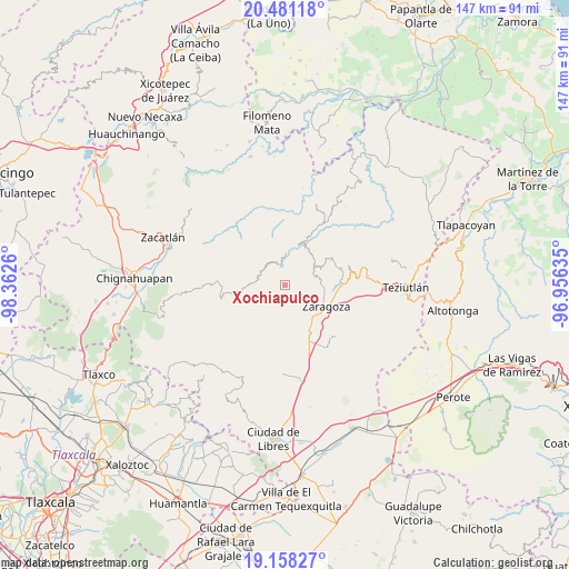
Xochiapulco GPS coordinates[2]
19° 49' 15.96" North, 97° 39' 34.092" West
| Map corner | latitude | longitude |
|---|---|---|
| Upper-left | 20.48118°, | -98.3626° |
| Center: | 19.8211°, | -97.65947° |
| Lower-right: | 19.15827°, | -96.95635° |
| Map W x H: | 147.1×147.1 km | = 91.4×91.4mi |
| max Lat: | 32.7° ⇑46.7% North |
| Xochiapulco: | 19.8211° |
| min Lat: | ⇓53.3% South 14.53588° |
| min Long | Xochiapulco | max Long |
| -117.105° | -97.65947° | -86.73105° |
| W 67.8%⇐ | ⇒32.2% E |
Elevation
Elevation of Xochiapulco is 2052 m = 6732 ft, and this is 798.3 m = 2619 ft above average elevation for this country.
| Max E: |
3497 m = 11473 ft | 23.8% |
| Xochiapulco | 2052 m 6732 ft | |
| Avg. | 1253.7 m = 4113 ft | |
Min E: |
-1 m = -3 ft | 76.2% |
See also: Mexico elevation on elevation.city.
Geographical zone
Xochiapulco is located in North Torrid zone (between Equator and Tropic of Cancer). Distance of this Northern Tropic circle is 402 km =249.8 mi to North.| Distance of | km | miles | from Xochiapulco |
|---|---|---|---|
| North Pole | 7803.2 | 4848.7 | to North |
| Arctic Circle | 5197.3 | 3229.5 | to North |
| Tropic Cancer | 402 | 249.8 | to North |
| Equator | 2203.9 | 1369.4 | to South |


Nearby cities:
15 places around Xochiapulco: (largest is in red/bold)
• Chilapa
6.2 km =3.9 mi,  175°
175°
• Comaltepec
7.6 km =4.7 mi,  56°
56°
• El Molino
8.3 km =5.2 mi,  95°
95°
• Francisco I. Madero
7.4 km =4.6 mi,  112°
112°
• Héroes del Cinco de Mayo
6.5 km =4 mi,  89°
89°
• Jilotepec
3.9 km =2.4 mi,  126°
126°
• La Libertad
9.1 km =5.7 mi,  143°
143°
• Las Lomas
4.9 km =3 mi, 86°
• Los Cristales (Talican)
8.9 km =5.5 mi,  50°
50°
• Rosa de Castilla
3.8 km =2.4 mi,  169°
169°
• San Francisco Zacapexpan
9.3 km =5.8 mi, 45°
• Santa Cruz Xaltetela
10.1 km =6.3 mi, 54°
• Texocoyohuac
8.7 km =5.4 mi,  123°
123°
• Xalticpac
7.1 km =4.4 mi,  69°
69°
• Zacapoaxtla
9.3 km =5.8 mi, 52°
Sources, notices
• [Note1] Compared only with cities in Mexico existing in our database
• [Src1] Map data: © OpenStreetMap contributors (CC-BY-SA)
• [Src2] Other city data from geonames.org with taken over terms of usage.
• [Src3] Geographical zone / Annual Mean Temperature by Robert A. Rohde @ Wikipedia
