Jilotepec geodata
Jilotepec (Puebla) is a populated place; located in Mexico in America/Mexico_City (GMT-6) time zone. With population of 537 people, there are 15796 cities with bigger population in this country. Compared to other cities in Mexico, 52.8% of cities are located further ↓South; 68.1% of cities are located further ←West and 73.6% of cities have lower elevation than Jilotepec. Note1


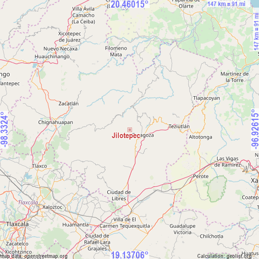
Jilotepec GPS coordinates[2]
19° 47' 59.928" North, 97° 37' 45.372" West
| Map corner | latitude | longitude |
|---|---|---|
| Upper-left | 20.46015°, | -98.3324° |
| Center: | 19.79998°, | -97.62927° |
| Lower-right: | 19.13706°, | -96.92615° |
| Map W x H: | 147.1×147.1 km | = 91.4×91.4mi |
| max Lat: | 32.7° ⇑47.2% North |
| Jilotepec: | 19.79998° |
| min Lat: | ⇓52.8% South 14.53588° |
| min Long | Jilotepec | max Long |
| -117.105° | -97.62927° | -86.73105° |
| W 68.1%⇐ | ⇒31.9% E |
Elevation
Elevation of Jilotepec is 2003 m = 6572 ft, and this is 749.3 m = 2458 ft above average elevation for this country.
| Max E: |
3497 m = 11473 ft | 26.4% |
| Jilotepec | 2003 m 6572 ft | |
| Avg. | 1253.7 m = 4113 ft | |
Min E: |
-1 m = -3 ft | 73.6% |
See also: Mexico elevation on elevation.city.
Geographical zone
Jilotepec is located in North Torrid zone (between Equator and Tropic of Cancer). Distance of this Northern Tropic circle is 404.4 km =251.3 mi to North.| Distance of | km | miles | from Jilotepec |
|---|---|---|---|
| North Pole | 7805.5 | 4850.1 | to North |
| Arctic Circle | 5199.6 | 3230.9 | to North |
| Tropic Cancer | 404.4 | 251.3 | to North |
| Equator | 2201.6 | 1368 | to South |


Nearby cities:
15 places around Jilotepec: (largest is in red/bold)
• Acuaco
8 km =5 mi,  121°
121°
• Chilapa
4.7 km =2.9 mi,  214°
214°
• Comaltepec
7.3 km =4.5 mi,  25°
25°
• El Molino
5.3 km =3.3 mi,  73°
73°
• Francisco I. Madero
3.7 km =2.3 mi,  98°
98°
• Héroes del Cinco de Mayo
4.2 km =2.6 mi,  54°
54°
• La Libertad
5.4 km =3.4 mi,  154°
154°
• Las Lomas
3.2 km =2 mi, 33°
• Morelos
7.4 km =4.6 mi,  132°
132°
• Rosa de Castilla
2.8 km =1.7 mi,  240°
240°
• San Francisco del Progreso
8.1 km =5 mi,  164°
164°
• San José Buenavista
7.3 km =4.5 mi,  113°
113°
• Texocoyohuac
4.8 km =3 mi, 121°
• Xalticpac
5.9 km =3.7 mi,  36°
36°
• Xochiapulco
3.9 km =2.4 mi,  306°
306°
Sources, notices
• [Note1] Compared only with cities in Mexico existing in our database
• [Src1] Map data: © OpenStreetMap contributors (CC-BY-SA)
• [Src2] Other city data from geonames.org with taken over terms of usage.
• [Src3] Geographical zone / Annual Mean Temperature by Robert A. Rohde @ Wikipedia
