Héroes del Cinco de Mayo geodata
Héroes del Cinco de Mayo (Puebla) is a populated place; located in Mexico in America/Mexico_City (GMT-6) time zone. With population of 660 people, there are 13154 cities with bigger population in this country. Compared to other cities in Mexico, 53.4% of cities are located further ↓South; 68.4% of cities are located further ←West and 76.9% of cities have lower elevation than Héroes del Cinco de Mayo. Note1
Current local time in Héroes del Cinco de Mayo:
08:32 AM, WednesdayDifference from your time zone: hours


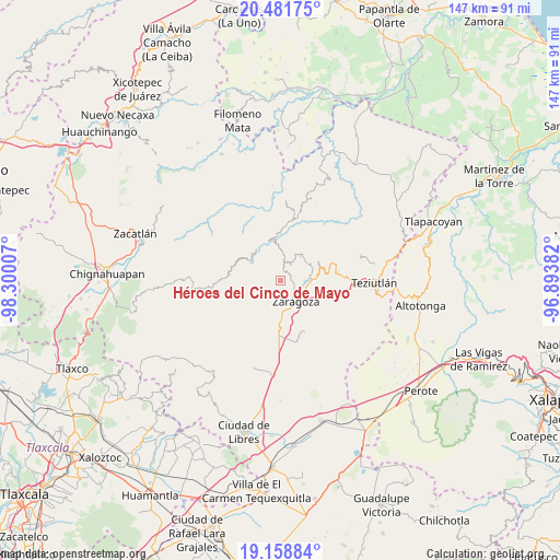
Héroes del Cinco de Mayo GPS coordinates[2]
19° 49' 18.012" North, 97° 35' 48.984" West
| Map corner | latitude | longitude |
|---|---|---|
| Upper-left | 20.48175°, | -98.30007° |
| Center: | 19.82167°, | -97.59694° |
| Lower-right: | 19.15884°, | -96.89382° |
| Map W x H: | 147.1×147.1 km | = 91.4×91.4mi |
| max Lat: | 32.7° ⇑46.6% North |
| Héroes del Cinco de Mayo: | 19.82167° |
| min Lat: | ⇓53.4% South 14.53588° |
| min Long | Héroes del Cin | max Long |
| -117.105° | -97.59694° | -86.73105° |
| W 68.4%⇐ | ⇒31.6% E |
Elevation
Elevation of Héroes del Cinco de Mayo is 2066 m = 6778 ft, and this is 812.3 m = 2665 ft above average elevation for this country.
| Max E: |
3497 m = 11473 ft | 23.1% |
| Héroes del Cinco de Mayo | 2066 m 6778 ft | |
| Avg. | 1253.7 m = 4113 ft | |
Min E: |
-1 m = -3 ft | 76.9% |
See also: Mexico elevation on elevation.city.
Geographical zone
Héroes del Cinco de Mayo is located in North Torrid zone (between Equator and Tropic of Cancer). Distance of this Northern Tropic circle is 402 km =249.8 mi to North.| Distance of | km | miles | from Héroes del Cinco de Mayo |
|---|---|---|---|
| North Pole | 7803.1 | 4848.6 | to North |
| Arctic Circle | 5197.2 | 3229.4 | to North |
| Tropic Cancer | 402 | 249.8 | to North |
| Equator | 2204 | 1369.5 | to South |


Nearby cities:
15 places around Héroes del Cinco de Mayo: (largest is in red/bold)
• Atalpan
4.6 km =2.9 mi,  57°
57°
• Comaltepec
4.2 km =2.6 mi,  356°
356°
• El Molino
2 km =1.2 mi,  118°
118°
• Francisco I. Madero
2.9 km =1.8 mi,  174°
174°
• Jilotepec
4.2 km =2.6 mi,  234°
234°
• Las Lomas
1.6 km =1 mi,  278°
278°
• Los Cristales (Talican)
5.6 km =3.5 mi,  2°
2°
• Nexticapan
4.5 km =2.8 mi,  82°
82°
• Plan de Guadalupe
5.1 km =3.2 mi,  109°
109°
• San José Buenavista
6.3 km =3.9 mi,  148°
148°
• Santa Cruz Xaltetela
6.1 km =3.8 mi,  16°
16°
• Tatoxcac
5.9 km =3.7 mi,  25°
25°
• Texocoyohuac
4.9 km =3 mi, 171°
• Xalticpac
2.4 km =1.5 mi, 3°
• Zacapoaxtla
5.7 km =3.5 mi,  8°
8°
Sources, notices
• [Note1] Compared only with cities in Mexico existing in our database
• [Src1] Map data: © OpenStreetMap contributors (CC-BY-SA)
• [Src2] Other city data from geonames.org with taken over terms of usage.
• [Src3] Geographical zone / Annual Mean Temperature by Robert A. Rohde @ Wikipedia
