Comaltepec geodata
Comaltepec (Puebla) is a populated place; located in Mexico in America/Mexico_City (GMT-6) time zone. With population of 3,236 people, there are 2800 cities with bigger population in this country. Compared to other cities in Mexico, 54.2% of cities are located further ↓South; 68.4% of cities are located further ←West and 69.8% of cities have lower elevation than Comaltepec. Note1


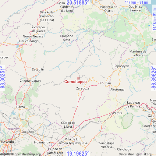
Comaltepec GPS coordinates[2]
19° 51' 32.148" North, 97° 35' 57.768" West
| Map corner | latitude | longitude |
|---|---|---|
| Upper-left | 20.51885°, | -98.30251° |
| Center: | 19.85893°, | -97.59938° |
| Lower-right: | 19.19625°, | -96.89626° |
| Map W x H: | 147.1×147.1 km | = 91.4×91.4mi |
| max Lat: | 32.7° ⇑45.8% North |
| Comaltepec: | 19.85893° |
| min Lat: | ⇓54.2% South 14.53588° |
| min Long | Comaltepec | max Long |
| -117.105° | -97.59938° | -86.73105° |
| W 68.4%⇐ | ⇒31.6% E |
Elevation
Elevation of Comaltepec is 1920 m = 6299 ft, and this is 666.3 m = 2186 ft above average elevation for this country.
| Max E: |
3497 m = 11473 ft | 30.2% |
| Comaltepec | 1920 m 6299 ft | |
| Avg. | 1253.7 m = 4113 ft | |
Min E: |
-1 m = -3 ft | 69.8% |
See also: Mexico elevation on elevation.city.
Geographical zone
Comaltepec is located in North Torrid zone (between Equator and Tropic of Cancer). Distance of this Northern Tropic circle is 397.8 km =247.2 mi to North.| Distance of | km | miles | from Comaltepec |
|---|---|---|---|
| North Pole | 7799 | 4846.1 | to North |
| Arctic Circle | 5193.1 | 3226.8 | to North |
| Tropic Cancer | 397.8 | 247.2 | to North |
| Equator | 2208.1 | 1372 | to South |


Nearby cities:
15 places around Comaltepec: (largest is in red/bold)
• Ahuacatlán
6.3 km =3.9 mi,  65°
65°
• Atalpan
4.4 km =2.7 mi,  112°
112°
• Cohuatzalpan
5.1 km =3.2 mi,  38°
38°
• Cuacuilco
5.9 km =3.7 mi,  98°
98°
• El Molino
5.4 km =3.4 mi,  158°
158°
• Héroes del Cinco de Mayo
4.2 km =2.6 mi,  176°
176°
• Las Lomas
4.1 km =2.5 mi,  199°
199°
• Los Cristales (Talican)
1.6 km =1 mi,  19°
19°
• Nexticapan
5.9 km =3.7 mi,  126°
126°
• San Francisco Zacapexpan
2.4 km =1.5 mi,  8°
8°
• Santa Cruz Xaltetela
2.6 km =1.6 mi,  48°
48°
• Tatoxcac
3 km =1.9 mi, 66°
• Xalacapan de Lucke
5.1 km =3.2 mi, 10°
• Xalticpac
1.8 km =1.1 mi,  167°
167°
• Zacapoaxtla
1.9 km =1.2 mi, 35°
Sources, notices
• [Note1] Compared only with cities in Mexico existing in our database
• [Src1] Map data: © OpenStreetMap contributors (CC-BY-SA)
• [Src2] Other city data from geonames.org with taken over terms of usage.
• [Src3] Geographical zone / Annual Mean Temperature by Robert A. Rohde @ Wikipedia
