Vizarrón geodata
Vizarrón (Querétaro) is a populated place; located in Mexico in America/Mexico_City (GMT-6) time zone. With population of 2,235 people, there are 3930 cities with bigger population in this country. Compared to other cities in Mexico, 73.8% of cities are located further ↓South; 60.5% of cities are located further →East and 76.8% of cities have lower elevation than Vizarrón. Note1


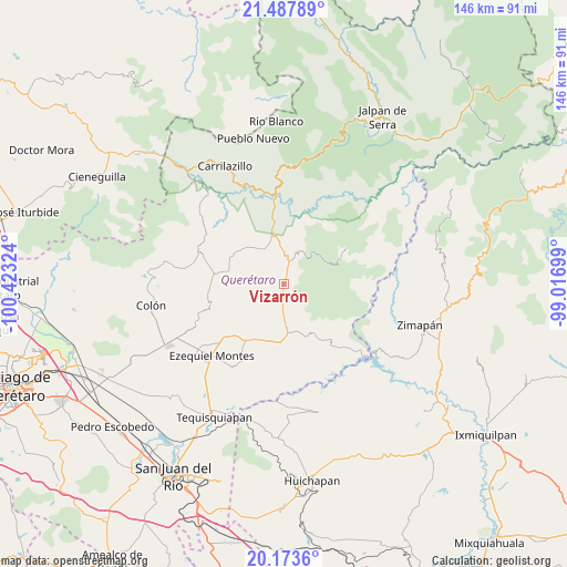
Vizarrón GPS coordinates[2]
20° 49' 55.848" North, 99° 43' 12.396" West
| Map corner | latitude | longitude |
|---|---|---|
| Upper-left | 21.48789°, | -100.42324° |
| Center: | 20.83218°, | -99.72011° |
| Lower-right: | 20.1736°, | -99.01699° |
| Map W x H: | 146.1×146.1 km | = 90.8×90.8mi |
| max Lat: | 32.7° ⇑26.2% North |
| Vizarrón: | 20.83218° |
| min Lat: | ⇓73.8% South 14.53588° |
| min Long | Vizarrón | max Long |
| -117.105° | -99.72011° | -86.73105° |
| W 39.5%⇐ | ⇒60.5% E |
Elevation
Elevation of Vizarrón is 2063 m = 6768 ft, and this is 809.3 m = 2655 ft above average elevation for this country.
| Max E: |
3497 m = 11473 ft | 23.2% |
| Vizarrón | 2063 m 6768 ft | |
| Avg. | 1253.7 m = 4113 ft | |
Min E: |
-1 m = -3 ft | 76.8% |
See also: Mexico elevation on elevation.city.
Geographical zone
Vizarrón is located in North Torrid zone (between Equator and Tropic of Cancer). Distance of this Northern Tropic circle is 289.6 km =179.9 mi to North.| Distance of | km | miles | from Vizarrón |
|---|---|---|---|
| North Pole | 7690.7 | 4778.8 | to North |
| Arctic Circle | 5084.9 | 3159.6 | to North |
| Tropic Cancer | 289.6 | 179.9 | to North |
| Equator | 2316.3 | 1439.3 | to South |


Nearby cities:
15 places around Vizarrón: (largest is in red/bold)
• Boyé
16.9 km =10.5 mi,  186°
186°
• Cadereyta
18 km =11.2 mi,  213°
213°
• Cerro Prieto
16.2 km =10.1 mi,  150°
150°
• El Palmar
15.5 km =9.6 mi,  174°
174°
• El Rincón
12.2 km =7.6 mi, 213°
• Higuerillas
10.5 km =6.5 mi,  333°
333°
• Los Juárez
8.3 km =5.2 mi,  60°
60°
• Puerto del Salitre
12.6 km =7.8 mi, 165°
• San Javier
8.8 km =5.5 mi,  177°
177°
• San Joaquín
18.6 km =11.6 mi, 60°
• San Martín Florida
13.8 km =8.6 mi,  232°
232°
• Santa Bárbara
12.6 km =7.8 mi,  221°
221°
• Sombrerete
7.2 km =4.5 mi,  130°
130°
• Villa Guerrero
15.6 km =9.7 mi,  195°
195°
• Zituní
17.5 km =10.9 mi, 220°
Sources, notices
• [Note1] Compared only with cities in Mexico existing in our database
• [Src1] Map data: © OpenStreetMap contributors (CC-BY-SA)
• [Src2] Other city data from geonames.org with taken over terms of usage.
• [Src3] Geographical zone / Annual Mean Temperature by Robert A. Rohde @ Wikipedia
