Ulumal geodata
Ulumal (Campeche) is a populated place; located in Mexico in America/Merida (GMT-6) time zone. With population of 833 people, there are 10503 cities with bigger population in this country. Compared to other cities in Mexico, 59.4% of cities are located further ↑North; 97.1% of cities are located further ←West and 97.5% of cities have higher elevation than Ulumal. Note1


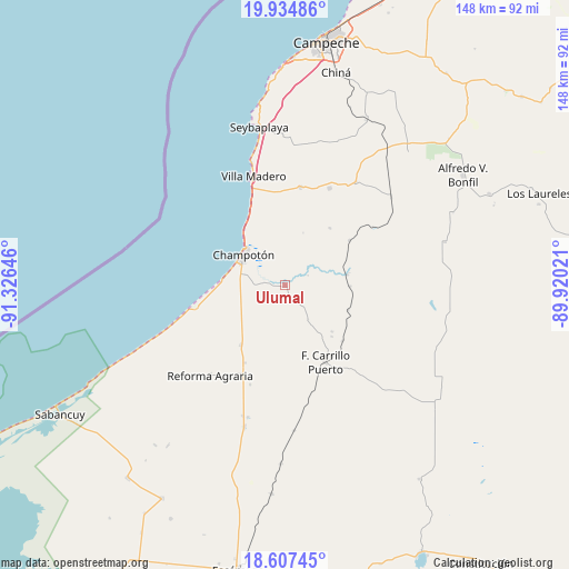
Ulumal GPS coordinates[2]
19° 16' 21" North, 90° 37' 23.988" West
| Map corner | latitude | longitude |
|---|---|---|
| Upper-left | 19.93486°, | -91.32646° |
| Center: | 19.2725°, | -90.62333° |
| Lower-right: | 18.60745°, | -89.92021° |
| Map W x H: | 147.6×147.6 km | = 91.7×91.7mi |
| max Lat: | 32.7° ⇑59.4% North |
| Ulumal: | 19.2725° |
| min Lat: | ⇓40.6% South 14.53588° |
| min Long | Ulumal | max Long |
| -117.105° | -90.62333° | -86.73105° |
| W 97.1%⇐ | ⇒2.9% E |
Elevation
Elevation of Ulumal is 9 m = 30 ft, and this is 1244.7 m = 4084 ft below average elevation for this country.
| Max E: |
3497 m = 11473 ft | 97.5% |
| Avg. | 1253.7 m = 4113 ft | |
| Ulumal | 9 m = 30 ft | |
Min E: |
-1 m = -3 ft | 2.5% |
See also: Mexico elevation on elevation.city.
Geographical zone
Ulumal is located in North Torrid zone (between Equator and Tropic of Cancer). Distance of this Northern Tropic circle is 463 km =287.7 mi to North.| Distance of | km | miles | from Ulumal |
|---|---|---|---|
| North Pole | 7864.2 | 4886.6 | to North |
| Arctic Circle | 5258.3 | 3267.4 | to North |
| Tropic Cancer | 463 | 287.7 | to North |
| Equator | 2142.9 | 1331.5 | to South |


Nearby cities:
15 places around Ulumal: (largest is in red/bold)
• Aquiles Serdán (Chuiná)
35.6 km =22.1 mi,  195°
195°
• Carrillo Puerto
22.5 km =14 mi,  151°
151°
• Champotón
13.2 km =8.2 mi,  309°
309°
• Ciudad del Sol
24.3 km =15.1 mi,  339°
339°
• Hool
32.5 km =20.2 mi,  34°
34°
• José María Morelos y Pavón
22.5 km =14 mi,  207°
207°
• La Joya
23.7 km =14.7 mi,  347°
347°
• Maya Tecún I
18.1 km =11.2 mi,  137°
137°
• Maya Tecún II
17.2 km =10.7 mi,  134°
134°
• Moquel
10.3 km =6.4 mi,  329°
329°
• Pustunich
20.8 km =12.9 mi, 133°
• San Pablo Pixtún
19.2 km =11.9 mi,  216°
216°
• Santo Domingo Kesté
27.9 km =17.3 mi,  24°
24°
• Sihochac
25.7 km =16 mi,  9°
9°
• Villa Madero
29.5 km =18.3 mi, 344°
Sources, notices
• [Note1] Compared only with cities in Mexico existing in our database
• [Src1] Map data: © OpenStreetMap contributors (CC-BY-SA)
• [Src2] Other city data from geonames.org with taken over terms of usage.
• [Src3] Geographical zone / Annual Mean Temperature by Robert A. Rohde @ Wikipedia
