José María Morelos y Pavón geodata
José María Morelos y Pavón (Campeche) is a populated place; located in Mexico in America/Merida (GMT-6) time zone. With population of 678 people, there are 12811 cities with bigger population in this country. Compared to other cities in Mexico, 63.3% of cities are located further ↑North; 97% of cities are located further ←West and 85.9% of cities have higher elevation than José María Morelos y Pavón. Note1
Current local time in José María Morelos y Pavón:
07:08 AM, WednesdayDifference from your time zone: hours


José María Morelos y Pavón GPS coordinates[2]
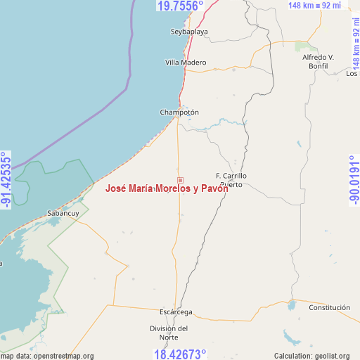
19° 5' 33" North, 90° 43' 19.992" West
| Map corner | latitude | longitude |
|---|---|---|
| Upper-left | 19.7556°, | -91.42535° |
| Center: | 19.0925°, | -90.72222° |
| Lower-right: | 18.42673°, | -90.0191° |
| Map W x H: | 147.8×147.8 km | = 91.8×91.8mi |
| max Lat: | 32.7° ⇑63.3% North |
| José María Morelos y Pavón: | 19.0925° |
| min Lat: | ⇓36.7% South 14.53588° |
| min Long | José María Mo | max Long |
| -117.105° | -90.72222° | -86.73105° |
| W 97%⇐ | ⇒3% E |
Elevation
Elevation of José María Morelos y Pavón is 39 m = 128 ft, and this is 1214.7 m = 3985 ft below average elevation for this country.
| Max E: |
3497 m = 11473 ft | 85.9% |
| Avg. | 1253.7 m = 4113 ft | |
| José María Morelos y Pavón | 39 m = 128 ft | |
Min E: |
-1 m = -3 ft | 14.1% |
See also: Mexico elevation on elevation.city.
Geographical zone
José María Morelos y Pavón is located in North Torrid zone (between Equator and Tropic of Cancer). Distance of this Northern Tropic circle is 483 km =300.1 mi to North.| Distance of | km | miles | from José María Morelos y Pavón |
|---|---|---|---|
| North Pole | 7884.2 | 4899 | to North |
| Arctic Circle | 5278.3 | 3279.8 | to North |
| Tropic Cancer | 483 | 300.1 | to North |
| Equator | 2122.9 | 1319.1 | to South |


Nearby cities:
15 places around José María Morelos y Pavón: (largest is in red/bold)
• Aquiles Serdán (Chuiná)
14.3 km =8.9 mi,  176°
176°
• Carrillo Puerto
21 km =13 mi,  89°
89°
• Champotón
28.3 km =17.6 mi,  0°
0°
• Cinco de Febrero
27.9 km =17.3 mi,  160°
160°
• General Ortiz Ávila
13.9 km =8.6 mi, 181°
• Ignacio Gutiérrez
31.6 km =19.6 mi,  227°
227°
• Maya Tecún I
23.6 km =14.7 mi,  73°
73°
• Maya Tecún II
24.1 km =15 mi, 70°
• Moquel
29.4 km =18.3 mi,  10°
10°
• Pixoyal
21.9 km =13.6 mi,  143°
143°
• Pustunich
26.1 km =16.2 mi,  77°
77°
• Revolución
21 km =13 mi, 182°
• San Pablo Pixtún
4.7 km =2.9 mi,  347°
347°
• Ulumal
22.5 km =14 mi,  27°
27°
• Xbacab
16.8 km =10.4 mi, 179°
Sources, notices
• [Note1] Compared only with cities in Mexico existing in our database
• [Src1] Map data: © OpenStreetMap contributors (CC-BY-SA)
• [Src2] Other city data from geonames.org with taken over terms of usage.
• [Src3] Geographical zone / Annual Mean Temperature by Robert A. Rohde @ Wikipedia
