Tuxtilla geodata
Tuxtilla (Veracruz) is a seat of a second-order administrative division; located in Mexico in America/Mexico_City (GMT-6) time zone. With population of 2,130 people, there are 4111 cities with bigger population in this country. Compared to other cities in Mexico, 75.7% of cities are located further ↑North; 82.5% of cities are located further ←West and 94.6% of cities have higher elevation than Tuxtilla. Note1


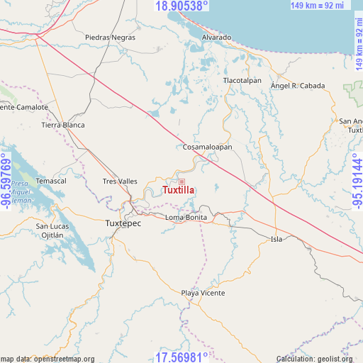
Tuxtilla GPS coordinates[2]
18° 14' 19.968" North, 95° 53' 40.416" West
| Map corner | latitude | longitude |
|---|---|---|
| Upper-left | 18.90538°, | -96.59769° |
| Center: | 18.23888°, | -95.89456° |
| Lower-right: | 17.56981°, | -95.19144° |
| Map W x H: | 148.5×148.5 km | = 92.3×92.3mi |
| max Lat: | 32.7° ⇑75.7% North |
| Tuxtilla: | 18.23888° |
| min Lat: | ⇓24.3% South 14.53588° |
| min Long | Tuxtilla | max Long |
| -117.105° | -95.89456° | -86.73105° |
| W 82.5%⇐ | ⇒17.5% E |
Elevation
Elevation of Tuxtilla is 14 m = 46 ft, and this is 1239.7 m = 4067 ft below average elevation for this country.
| Max E: |
3497 m = 11473 ft | 94.6% |
| Avg. | 1253.7 m = 4113 ft | |
| Tuxtilla | 14 m = 46 ft | |
Min E: |
-1 m = -3 ft | 5.4% |
See also: Mexico elevation on elevation.city.
Geographical zone
Tuxtilla is located in North Torrid zone (between Equator and Tropic of Cancer). Distance of this Northern Tropic circle is 577.9 km =359.1 mi to North.| Distance of | km | miles | from Tuxtilla |
|---|---|---|---|
| North Pole | 7979.1 | 4958 | to North |
| Arctic Circle | 5373.2 | 3338.8 | to North |
| Tropic Cancer | 577.9 | 359.1 | to North |
| Equator | 2028 | 1260.1 | to South |


Nearby cities:
15 places around Tuxtilla: (largest is in red/bold)
• Arroyo del Soldado (Arroyo del Obispo)
14.9 km =9.3 mi,  55°
55°
• Benito Juárez
4.6 km =2.9 mi,  0°
0°
• Cerro Colorado
7.4 km =4.6 mi,  39°
39°
• Chacaltianguis
9.3 km =5.8 mi, 37°
• El Mirador
14.5 km =9 mi,  359°
359°
• Fernando López Arias
12.9 km =8 mi,  338°
338°
• Las Sabanetas
14.6 km =9.1 mi,  148°
148°
• Loma Bonita
14.7 km =9.1 mi,  173°
173°
• Los Bálsamos
11.9 km =7.4 mi,  354°
354°
• Mata de Caña
6.5 km =4 mi,  114°
114°
• Nopaltepec
11.8 km =7.3 mi,  290°
290°
• Paraiso Novillero
4.7 km =2.9 mi, 289°
• San Francisco (Oyozontle)
11.3 km =7 mi,  27°
27°
• San Isidro
9.9 km =6.2 mi,  282°
282°
• Tlacojalpan
5.6 km =3.5 mi,  260°
260°
Sources, notices
• [Note1] Compared only with cities in Mexico existing in our database
• [Src1] Map data: © OpenStreetMap contributors (CC-BY-SA)
• [Src2] Other city data from geonames.org with taken over terms of usage.
• [Src3] Geographical zone / Annual Mean Temperature by Robert A. Rohde @ Wikipedia
