San Francisco (Oyozontle) geodata
San Francisco (Oyozontle) (Veracruz) is a populated place; located in Mexico in America/Mexico_City (GMT-6) time zone. With population of 752 people, there are 11651 cities with bigger population in this country. Compared to other cities in Mexico, 74.5% of cities are located further ↑North; 82.6% of cities are located further ←West and 94% of cities have higher elevation than San Francisco (Oyozontle). Note1
Current local time in San Francisco (Oyozontle):
07:04 AM, WednesdayDifference from your time zone: hours


San Francisco (Oyozontle) GPS coordinates[2]
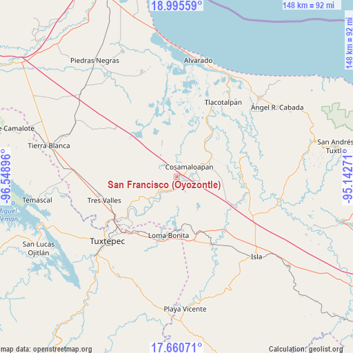
18° 19' 45.984" North, 95° 50' 44.988" West
| Map corner | latitude | longitude |
|---|---|---|
| Upper-left | 18.99559°, | -96.54896° |
| Center: | 18.32944°, | -95.84583° |
| Lower-right: | 17.66071°, | -95.14271° |
| Map W x H: | 148.4×148.4 km | = 92.2×92.2mi |
| max Lat: | 32.7° ⇑74.5% North |
| San Francisco (Oyozontle): | 18.32944° |
| min Lat: | ⇓25.5% South 14.53588° |
| min Long | San Francisco ( | max Long |
| -117.105° | -95.84583° | -86.73105° |
| W 82.6%⇐ | ⇒17.4% E |
Elevation
Elevation of San Francisco (Oyozontle) is 15 m = 49 ft, and this is 1238.7 m = 4064 ft below average elevation for this country.
| Max E: |
3497 m = 11473 ft | 94% |
| Avg. | 1253.7 m = 4113 ft | |
| San Francisco (Oyozontle) | 15 m = 49 ft | |
Min E: |
-1 m = -3 ft | 6% |
See also: Mexico elevation on elevation.city.
Geographical zone
San Francisco (Oyozontle) is located in North Torrid zone (between Equator and Tropic of Cancer). Distance of this Northern Tropic circle is 567.9 km =352.9 mi to North.| Distance of | km | miles | from San Francisco (Oyozontle) |
|---|---|---|---|
| North Pole | 7969 | 4951.7 | to North |
| Arctic Circle | 5363.1 | 3332.5 | to North |
| Tropic Cancer | 567.9 | 352.9 | to North |
| Equator | 2038 | 1266.4 | to South |


Nearby cities:
15 places around San Francisco (Oyozontle): (largest is in red/bold)
• Arroyo del Soldado (Arroyo del Obispo)
7.3 km =4.5 mi,  102°
102°
• Benito Juárez
7.5 km =4.7 mi,  222°
222°
• Carlos A. Carrillo
10.9 km =6.8 mi,  62°
62°
• Cerro Colorado
4.4 km =2.7 mi,  185°
185°
• Chacaltianguis
2.7 km =1.7 mi,  170°
170°
• Chicalpextle
6.9 km =4.3 mi,  12°
12°
• Cosamaloapan
6.5 km =4 mi,  49°
49°
• El Mirador
6.8 km =4.2 mi,  310°
310°
• Fernando López Arias
10 km =6.2 mi,  281°
281°
• Los Bálsamos
6.5 km =4 mi,  285°
285°
• Mata de Caña
12.8 km =8 mi,  176°
176°
• Mozapa
8 km =5 mi,  358°
358°
• Pachuca
9.3 km =5.8 mi, 358°
• Tilapa
9.3 km =5.8 mi, 100°
• Tuxtilla
11.3 km =7 mi,  207°
207°
Sources, notices
• [Note1] Compared only with cities in Mexico existing in our database
• [Src1] Map data: © OpenStreetMap contributors (CC-BY-SA)
• [Src2] Other city data from geonames.org with taken over terms of usage.
• [Src3] Geographical zone / Annual Mean Temperature by Robert A. Rohde @ Wikipedia
