Los Bálsamos geodata
Los Bálsamos (Veracruz) is a populated place; located in Mexico in America/Mexico_City (GMT-6) time zone. With population of 543 people, there are 15651 cities with bigger population in this country. Compared to other cities in Mexico, 74.4% of cities are located further ↑North; 82.5% of cities are located further ←West and 94% of cities have higher elevation than Los Bálsamos. Note1


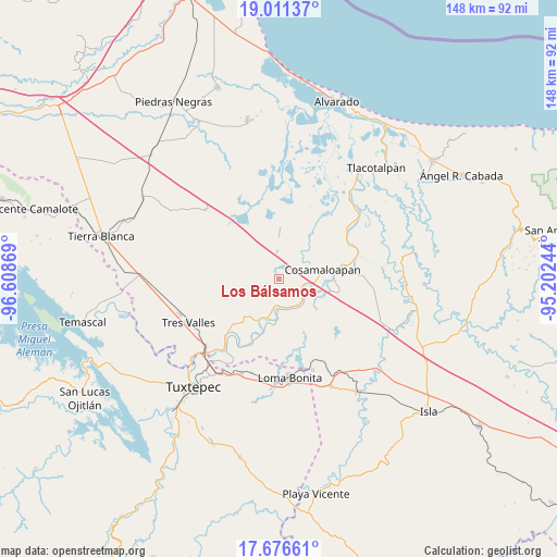
Los Bálsamos GPS coordinates[2]
18° 20' 43.008" North, 95° 54' 20.016" West
| Map corner | latitude | longitude |
|---|---|---|
| Upper-left | 19.01137°, | -96.60869° |
| Center: | 18.34528°, | -95.90556° |
| Lower-right: | 17.67661°, | -95.20244° |
| Map W x H: | 148.4×148.4 km | = 92.2×92.2mi |
| max Lat: | 32.7° ⇑74.4% North |
| Los Bálsamos: | 18.34528° |
| min Lat: | ⇓25.6% South 14.53588° |
| min Long | Los Bálsamos | max Long |
| -117.105° | -95.90556° | -86.73105° |
| W 82.5%⇐ | ⇒17.5% E |
Elevation
Elevation of Los Bálsamos is 15 m = 49 ft, and this is 1238.7 m = 4064 ft below average elevation for this country.
| Max E: |
3497 m = 11473 ft | 94% |
| Avg. | 1253.7 m = 4113 ft | |
| Los Bálsamos | 15 m = 49 ft | |
Min E: |
-1 m = -3 ft | 6% |
See also: Mexico elevation on elevation.city.
Geographical zone
Los Bálsamos is located in North Torrid zone (between Equator and Tropic of Cancer). Distance of this Northern Tropic circle is 566.1 km =351.8 mi to North.| Distance of | km | miles | from Los Bálsamos |
|---|---|---|---|
| North Pole | 7967.3 | 4950.6 | to North |
| Arctic Circle | 5361.4 | 3331.4 | to North |
| Tropic Cancer | 566.1 | 351.8 | to North |
| Equator | 2039.8 | 1267.5 | to South |


Nearby cities:
15 places around Los Bálsamos: (largest is in red/bold)
• Benito Juárez
7.4 km =4.6 mi,  170°
170°
• Cerro Colorado
8.5 km =5.3 mi,  136°
136°
• Chacaltianguis
8.1 km =5 mi,  123°
123°
• Chicalpextle
9.3 km =5.8 mi,  57°
57°
• Cosamaloapan
11.6 km =7.2 mi,  77°
77°
• El Mirador
2.9 km =1.8 mi,  22°
22°
• Fernando López Arias
3.5 km =2.2 mi,  273°
273°
• Mozapa
8.7 km =5.4 mi,  44°
44°
• Nopaltepec
12.5 km =7.8 mi,  232°
232°
• Pachuca
9.6 km =6 mi, 38°
• Paraiso Novillero
10.8 km =6.7 mi,  197°
197°
• San Francisco (Oyozontle)
6.5 km =4 mi,  105°
105°
• San Isidro
12.9 km =8 mi,  221°
221°
• Tlacojalpan
13.4 km =8.3 mi, 198°
• Tuxtilla
11.9 km =7.4 mi, 174°
Sources, notices
• [Note1] Compared only with cities in Mexico existing in our database
• [Src1] Map data: © OpenStreetMap contributors (CC-BY-SA)
• [Src2] Other city data from geonames.org with taken over terms of usage.
• [Src3] Geographical zone / Annual Mean Temperature by Robert A. Rohde @ Wikipedia
