Tultepec geodata
Tultepec (State of Mexico) is a populated place; located in Mexico in America/Mexico_City (GMT-6) time zone. With population of 65,338 people, there are 182 cities with bigger population in this country. Compared to other cities in Mexico, 50% of cities are located further ↓South; 51.6% of cities are located further →East and 84.9% of cities have lower elevation than Tultepec. Note1


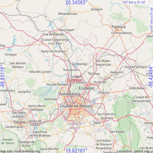
Tultepec GPS coordinates[2]
19° 41' 6" North, 99° 7' 41.016" West
| Map corner | latitude | longitude |
|---|---|---|
| Upper-left | 20.34565°, | -99.83119° |
| Center: | 19.685°, | -99.12806° |
| Lower-right: | 19.02161°, | -98.42494° |
| Map W x H: | 147.2×147.2 km | = 91.5×91.5mi |
| max Lat: | 32.7° ⇑50% North |
| Tultepec: | 19.685° |
| min Lat: | ⇓50% South 14.53588° |
| min Long | Tultepec | max Long |
| -117.105° | -99.12806° | -86.73105° |
| W 48.4%⇐ | ⇒51.6% E |
Elevation
Elevation of Tultepec is 2257 m = 7405 ft, and this is 1003.3 m = 3292 ft above average elevation for this country.
| Max E: |
3497 m = 11473 ft | 15.1% |
| Tultepec | 2257 m 7405 ft | |
| Avg. | 1253.7 m = 4113 ft | |
Min E: |
-1 m = -3 ft | 84.9% |
See also: Tultepec elevation on elevation.city.
Geographical zone
Tultepec is located in North Torrid zone (between Equator and Tropic of Cancer). Distance of this Northern Tropic circle is 417.2 km =259.2 mi to North.| Distance of | km | miles | from Tultepec |
|---|---|---|---|
| North Pole | 7818.3 | 4858.1 | to North |
| Arctic Circle | 5212.4 | 3238.8 | to North |
| Tropic Cancer | 417.2 | 259.2 | to North |
| Equator | 2188.8 | 1360.1 | to South |


Nearby cities:
15 places around Tultepec: (largest is in red/bold)
• Colonia 2 de Septiembre
2.1 km =1.3 mi,  34°
34°
• Ejido San Pablito (Paraje San Pablito)
2 km =1.2 mi,  150°
150°
• Ejido de Teyahualco
4.5 km =2.8 mi,  207°
207°
• El Progreso (Villa Esmeralda)
4.6 km =2.9 mi,  87°
87°
• Fracción San Roque (El Prieto)
4.6 km =2.9 mi,  273°
273°
• La Trinidad
4.6 km =2.9 mi,  263°
263°
• Lomas de Tenopalco
2.5 km =1.6 mi,  40°
40°
• Los Álamos II
4.5 km =2.8 mi,  346°
346°
• Melchor Ocampo
2.6 km =1.6 mi,  316°
316°
• Paraje Trigo Tenco
1.5 km =0.9 mi,  140°
140°
• San Antonio Xahuento
2.3 km =1.4 mi,  71°
71°
• San Francisco Tenopalco
3.3 km =2.1 mi,  22°
22°
• San Mateo Ixtacalco
4.8 km =3 mi,  289°
289°
• San Pablo de las Salinas
4 km =2.5 mi,  120°
120°
• Santiago Teyahualco
2.8 km =1.7 mi,  173°
173°
Sources, notices
• [Note1] Compared only with cities in Mexico existing in our database
• [Src1] Map data: © OpenStreetMap contributors (CC-BY-SA)
• [Src2] Other city data from geonames.org with taken over terms of usage.
• [Src3] Geographical zone / Annual Mean Temperature by Robert A. Rohde @ Wikipedia
