Colonia Central geodata
Colonia Central (Chiapas) is a populated place; located in Mexico in America/Mexico_City (GMT-6) time zone. With population of 816 people, there are 10702 cities with bigger population in this country. Compared to other cities in Mexico, 98% of cities are located further ↑North; 87.2% of cities are located further ←West and 87% of cities have higher elevation than Colonia Central. Note1


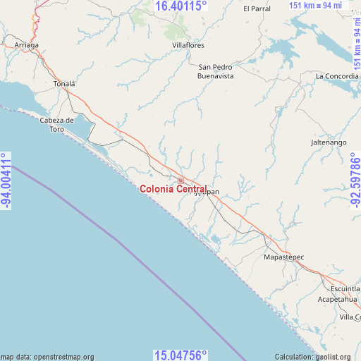
Colonia Central GPS coordinates[2]
15° 43' 31.728" North, 93° 18' 3.528" West
| Map corner | latitude | longitude |
|---|---|---|
| Upper-left | 16.40115°, | -94.00411° |
| Center: | 15.72548°, | -93.30098° |
| Lower-right: | 15.04756°, | -92.59786° |
| Map W x H: | 150.5×150.5 km | = 93.5×93.5mi |
| max Lat: | 32.7° ⇑98% North |
| Colonia Central: | 15.72548° |
| min Lat: | ⇓2% South 14.53588° |
| min Long | Colonia Central | max Long |
| -117.105° | -93.30098° | -86.73105° |
| W 87.2%⇐ | ⇒12.8% E |
Elevation
Elevation of Colonia Central is 34 m = 112 ft, and this is 1219.7 m = 4002 ft below average elevation for this country.
| Max E: |
3497 m = 11473 ft | 87% |
| Avg. | 1253.7 m = 4113 ft | |
| Colonia Central | 34 m = 112 ft | |
Min E: |
-1 m = -3 ft | 13% |
See also: Mexico elevation on elevation.city.
Geographical zone
Colonia Central is located in North Torrid zone (between Equator and Tropic of Cancer). Distance of this Northern Tropic circle is 857.4 km =532.8 mi to North.| Distance of | km | miles | from Colonia Central |
|---|---|---|---|
| North Pole | 8258.6 | 5131.7 | to North |
| Arctic Circle | 5652.7 | 3512.4 | to North |
| Tropic Cancer | 857.4 | 532.8 | to North |
| Equator | 1748.5 | 1086.5 | to South |


Nearby cities:
15 places around Colonia Central: (largest is in red/bold)
• El Carmen
24.9 km =15.5 mi,  132°
132°
• El Manguito
24.6 km =15.3 mi,  278°
278°
• El Palmarcito
27 km =16.8 mi,  159°
159°
• Guanajuato
17.8 km =11.1 mi,  119°
119°
• Joaquín Miguel Gutiérrez (Margaritas)
29.6 km =18.4 mi, 131°
• La Esperanza
33.9 km =21.1 mi,  154°
154°
• Las Brisas
30.4 km =18.9 mi,  139°
139°
• Manuel Ávila Camacho (Ponte Duro)
32.2 km =20 mi,  286°
286°
• Nueva Coapa (Estación Echegaray)
18.3 km =11.4 mi, 127°
• Pijijiapan
10.7 km =6.6 mi,  114°
114°
• Plan de Ayala
29.2 km =18.1 mi,  104°
104°
• Progreso
21.8 km =13.5 mi, 130°
• San Isidro
5.9 km =3.7 mi, 290°
• Tamaulipas
12.5 km =7.8 mi, 294°
• Tres Picos
29.9 km =18.6 mi,  305°
305°
Sources, notices
• [Note1] Compared only with cities in Mexico existing in our database
• [Src1] Map data: © OpenStreetMap contributors (CC-BY-SA)
• [Src2] Other city data from geonames.org with taken over terms of usage.
• [Src3] Geographical zone / Annual Mean Temperature by Robert A. Rohde @ Wikipedia
