Totutla geodata
Totutla (Veracruz) is a seat of a second-order administrative division; located in Mexico in America/Mexico_City (GMT-6) time zone. With population of 3,802 people, there are 2403 cities with bigger population in this country. Compared to other cities in Mexico, 60.9% of cities are located further ↑North; 75.4% of cities are located further ←West and 50.3% of cities have lower elevation than Totutla. Note1


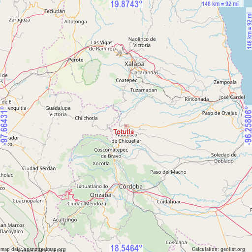
Totutla GPS coordinates[2]
19° 12' 42.084" North, 96° 57' 40.248" West
| Map corner | latitude | longitude |
|---|---|---|
| Upper-left | 19.8743°, | -97.66431° |
| Center: | 19.21169°, | -96.96118° |
| Lower-right: | 18.5464°, | -96.25806° |
| Map W x H: | 147.6×147.7 km | = 91.7×91.8mi |
| max Lat: | 32.7° ⇑60.9% North |
| Totutla: | 19.21169° |
| min Lat: | ⇓39.1% South 14.53588° |
| min Long | Totutla | max Long |
| -117.105° | -96.96118° | -86.73105° |
| W 75.4%⇐ | ⇒24.6% E |
Elevation
Elevation of Totutla is 1449 m = 4754 ft, and this is 195.3 m = 641 ft above average elevation for this country.
| Max E: |
3497 m = 11473 ft | 49.7% |
| Totutla | 1449 m 4754 ft | |
| Avg. | 1253.7 m = 4113 ft | |
Min E: |
-1 m = -3 ft | 50.3% |
See also: Mexico elevation on elevation.city.
Geographical zone
Totutla is located in North Torrid zone (between Equator and Tropic of Cancer). Distance of this Northern Tropic circle is 469.8 km =291.9 mi to North.| Distance of | km | miles | from Totutla |
|---|---|---|---|
| North Pole | 7870.9 | 4890.7 | to North |
| Arctic Circle | 5265 | 3271.5 | to North |
| Tropic Cancer | 469.8 | 291.9 | to North |
| Equator | 2136.1 | 1327.3 | to South |


Nearby cities:
15 places around Totutla: (largest is in red/bold)
• Adolfo Ruiz Cortines (La Pastoría)
8.4 km =5.2 mi,  208°
208°
• Colonia Pastoría Cuatro
7.2 km =4.5 mi,  199°
199°
• Cosolapo
4 km =2.5 mi,  97°
97°
• El Triunfo
8.3 km =5.2 mi,  285°
285°
• Elotepec
8.4 km =5.2 mi,  251°
251°
• Huatusco
7 km =4.3 mi,  185°
185°
• Ohuapan
5.1 km =3.2 mi,  328°
328°
• Pinillo
9.4 km =5.8 mi,  14°
14°
• San Martín Comalapa
7.8 km =4.8 mi, 328°
• Sochiapa
3.1 km =1.9 mi,  133°
133°
• Tenampa
9.1 km =5.7 mi,  63°
63°
• Tlapala
7.1 km =4.4 mi,  38°
38°
• Tomatlancillo
4.9 km =3 mi,  140°
140°
• Totolapa (Cruz Verde)
1.1 km =0.7 mi, 194°
• Zapotitla
3 km =1.9 mi, 35°
Sources, notices
• [Note1] Compared only with cities in Mexico existing in our database
• [Src1] Map data: © OpenStreetMap contributors (CC-BY-SA)
• [Src2] Other city data from geonames.org with taken over terms of usage.
• [Src3] Geographical zone / Annual Mean Temperature by Robert A. Rohde @ Wikipedia
