Sochiapa geodata
Sochiapa (Veracruz) is a seat of a second-order administrative division; located in Mexico in America/Mexico_City (GMT-6) time zone. With population of 1,067 people, there are 8174 cities with bigger population in this country. Compared to other cities in Mexico, 61.4% of cities are located further ↑North; 75.7% of cities are located further ←West and 52% of cities have higher elevation than Sochiapa. Note1


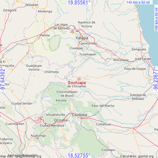
Sochiapa GPS coordinates[2]
19° 11' 34.512" North, 96° 56' 23.604" West
| Map corner | latitude | longitude |
|---|---|---|
| Upper-left | 19.85561°, | -97.64302° |
| Center: | 19.19292°, | -96.93989° |
| Lower-right: | 18.52755°, | -96.23677° |
| Map W x H: | 147.7×147.7 km | = 91.8×91.8mi |
| max Lat: | 32.7° ⇑61.4% North |
| Sochiapa: | 19.19292° |
| min Lat: | ⇓38.6% South 14.53588° |
| min Long | Sochiapa | max Long |
| -117.105° | -96.93989° | -86.73105° |
| W 75.7%⇐ | ⇒24.3% E |
Elevation
Elevation of Sochiapa is 1340 m = 4396 ft, and this is 86.3 m = 283 ft above average elevation for this country.
| Max E: |
3497 m = 11473 ft | 52% |
| Sochiapa | 1340 m 4396 ft | |
| Avg. | 1253.7 m = 4113 ft | |
Min E: |
-1 m = -3 ft | 48% |
See also: Mexico elevation on elevation.city.
Geographical zone
Sochiapa is located in North Torrid zone (between Equator and Tropic of Cancer). Distance of this Northern Tropic circle is 471.9 km =293.2 mi to North.| Distance of | km | miles | from Sochiapa |
|---|---|---|---|
| North Pole | 7873 | 4892.1 | to North |
| Arctic Circle | 5267.1 | 3272.8 | to North |
| Tropic Cancer | 471.9 | 293.2 | to North |
| Equator | 2134.1 | 1326.1 | to South |


Nearby cities:
15 places around Sochiapa: (largest is in red/bold)
• Adolfo Ruiz Cortines (La Pastoría)
8.2 km =5.1 mi,  230°
230°
• Colonia Pastoría Cuatro
6.6 km =4.1 mi,  224°
224°
• Comapa
6.5 km =4 mi,  119°
119°
• Cosolapo
2.4 km =1.5 mi,  47°
47°
• Coyolito
8.3 km =5.2 mi,  62°
62°
• Huatusco
5.7 km =3.5 mi,  210°
210°
• Ixpila
8.8 km =5.5 mi,  198°
198°
• Mesa del Rancho
7.3 km =4.5 mi,  187°
187°
• Ohuapan
8.1 km =5 mi,  322°
322°
• Tenampa
8.6 km =5.3 mi,  43°
43°
• Tlapala
8 km =5 mi,  16°
16°
• Tomatlancillo
1.9 km =1.2 mi,  152°
152°
• Totolapa (Cruz Verde)
2.7 km =1.7 mi,  291°
291°
• Totutla
3.1 km =1.9 mi,  313°
313°
• Zapotitla
4.6 km =2.9 mi,  353°
353°
Sources, notices
• [Note1] Compared only with cities in Mexico existing in our database
• [Src1] Map data: © OpenStreetMap contributors (CC-BY-SA)
• [Src2] Other city data from geonames.org with taken over terms of usage.
• [Src3] Geographical zone / Annual Mean Temperature by Robert A. Rohde @ Wikipedia
